
Castropol-Figueras coastal walk
- Castropol
- Linear route
- 8 km round trip
- 2 hours
- Download
The trail starts at the entrance of the village, where we will find a suitable place to leave the car. After a few meters we will find an information panel that will give us a general idea of the itinerary.
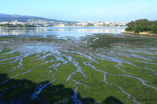
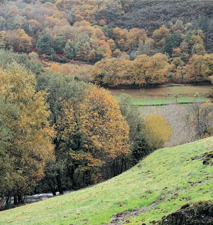
We continue until we reach Salías, from here we can see a large part of the Linera inlet, Castropol on the left side, Figueras on the right side and in the background Ribadeo and the bridge of Los Santos; the islet of Turullón with its unique silhouette. At low tide you can see the oyster and mollusc crops of the Eo estuary. Spectacular is the contrast offered by the blue of the estuary with the green meadows that surround it. Our next stop is the Esquilo viaduct where we find a small Ribera carpentry. The only survivor of the many that once existed in the area, dedicated to the construction of fishing boats. Behind it, the inlet of the Linera is the contrast that offers a fantastic panoramic view. And a little further on we go back in time to contemplate the remains of the mill of As Acías, an old tide mill. Nearby two small coves offer us the possibility of a swim. We end the route in Figueras, a unique fishing village that deserves a visit. The way back runs through the same place, if we are tired and it is summer we have the possibility of returning by boat.
Hiking trails
-
Ouroso Route
- Taramundi
 7.8 km
 3 hours
 Download
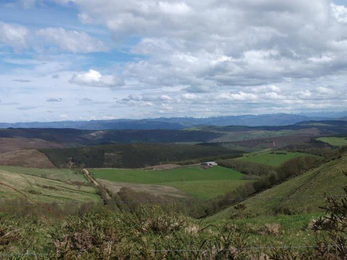
In the Teixo and just behind the hostel starts the forest track along which begins the walk to the Alto de Ouroso. The path is wide and passable by all-terrain vehicles, so there is hardly any possibility of getting lost. The route runs comfortably between wide pastures, heaths and pine forests of repopulation to reach a landing on which there is a small lagoon where at mid-morning many horses come to this point to water and refresh themselves in the shade of the pines. The animals graze in a semi-wild state and require little attention from their owners, which is why the number of horses has increased considerably in recent years.
-
Teixo – Os Teixois Route
- Taramundi
- 10 km
- 3 hours and 45 minutes
- Media
The itinerary begins in Teixo, where after leaving the vehicle and passing the last houses we start an easy walk along the road that connects this town with Santa Marina, leaving it to the right by a wide dirt track that leads us after a slight descent to the Arroyo das Mestas.
-
As Minas Greenway
- Vegadeo
- 13 km
- 4 hours
- Media
The route starts in the town of A Espía (Vegadeo) and is accessed through the AS-11 road that connects Vegadeo with Los Oscos.
-
A Coba Route
- Santa Eulalia de Oscos
- 14.5 km
- 5 hours
- Medium - high
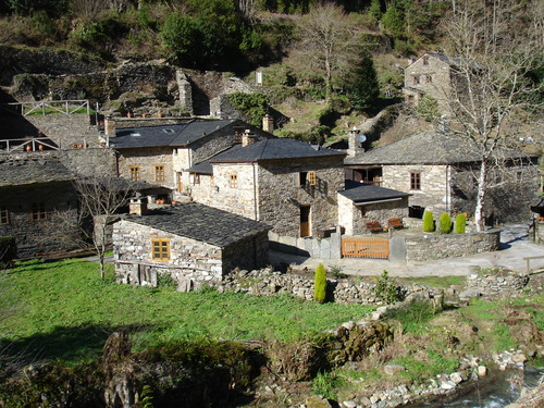
We start the route in the beautiful village of Ferreira, one of the best preserved of the municipality, where we can admire the popular architecture of the area while walking along its narrow paths in the shade of centuries-old vines.
-
Water Route
- Taramundi
- 14 km
- 4 hours and 30 minutes
- Download
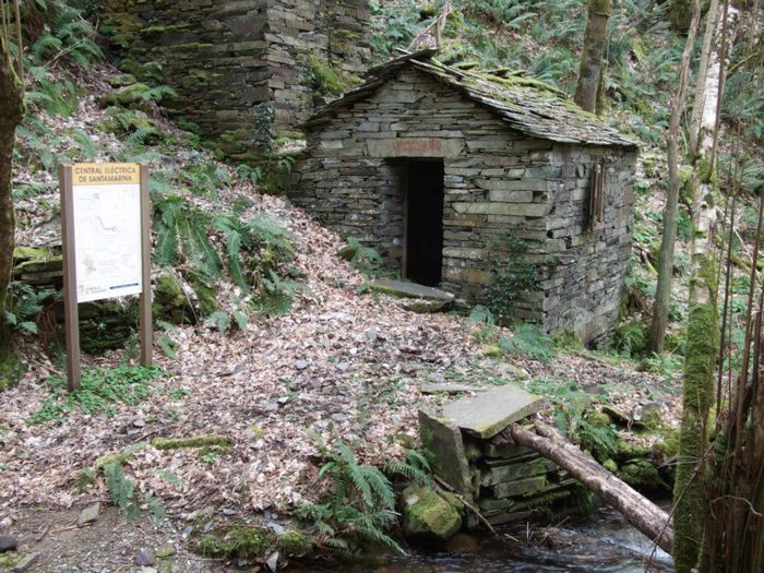
Its fourteen kilometers allow us to enjoy the water and its use for centuries in the rural environment. From the lower part of Taramundi we take a road that leads us to Mazonovo, where we can visit the Museum of Mills.
-
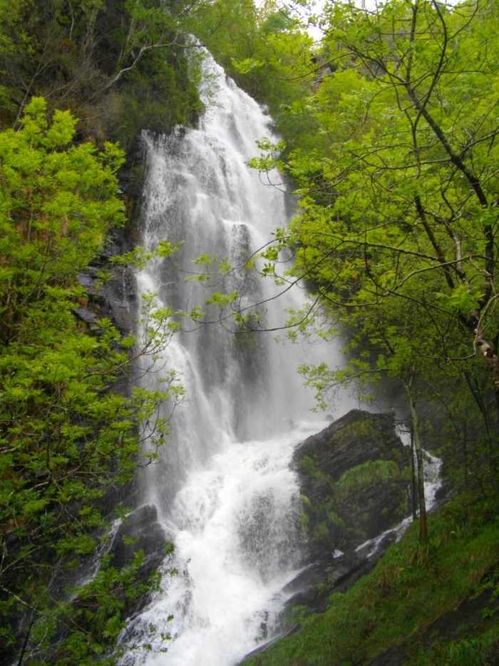
A Seimeira Route
- Santa Eulalia de Oscos
- 8 km round trip
- 3 hours
- Download
The route begins in the recreational area of Pumares; we cross the road and head parallel to the river to Pumares, a village of old ferreira activity, where we can still see the remains of an old mallet. From here, along a marked path, and leaving the river Agüeira to our left, we continue a slight ascent into a legendary forest characterized by riparian species (alders, ashes, willows, and hazelnut trees) and by oaks and chestnut trees that with their whimsical shapes are true monuments.