
A Pena do Encanto Route
- San Tirso de Abres
- Circular route
- 4 km
- 1 hour and 20 minutes
- Download
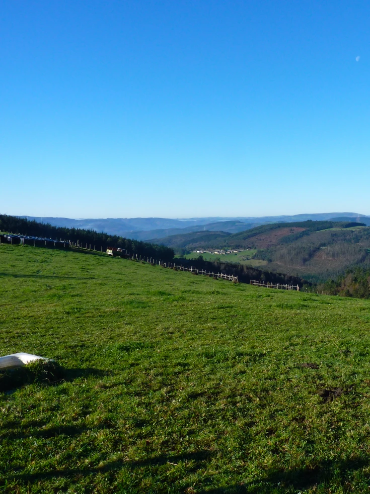
From the municipal capital we go to the exit of the town towards Galicia, finding ourselves on the right hand side with the San Isidro square in whose center is the chapel with the same name, coinciding with the starting point of the route.
We will follow the asphalt road to Vilela de Abajo stretch in which we will observe the municipal capital in the area known as El Llano, seated on a valley surrounded by gentle mountains, crossed from SW to NW by the course of the river Eo, riverbed around which the history and life of the municipality has developed. Already in Vilela we will turn left to enter a dirt track surrounded by forest that brings us closer to the stream of Ramalledo, responsible for watering numerous forests of native flora that settle along its course. Once we go up the stream we reach the area known as Pena do Encanto where a mysterious waterfall flows between water and stone, where the legend of an enchanted lady who comes out of the rock with a golden comb every night of San Juan to bewitch whoever sees her still beats. From this place we start the way back on our steps, arriving at a crossroads where we must turn right to start a slight ascent to Vilela de Arriba, a village through which we must pass before arriving back to the starting point.
Hiking trails
-
Green path of San Martín de Oscos
- San Martín de Oscos
 7.5 km
 3 hours
 Download
This is a circular route of about 7.5 km that starts and ends in the village of San Martín de Oscos. We start the route next to the tourist office going up to A Bouza, where we will contemplate an exceptional view of the village.
-
Railroad Route
- San Tirso de Abres
- 15 km
- 5 hours
- Download
We start the walk in the old station of San Tirso de Abres, today restored for private housing, finding the first of the six tunnels just 300 m away, continuing next to the river Eo enjoying every moment of great panoramic views of the riverbed, of incalculable ecological and fish value, in which abound a large number of aquatic species, the most characteristic being trout, lamprey and salmon. Later the path crosses the N-640 road and leads us to an old power station built in 1932, located just before crossing another of the tunnels drilled in the rock, which leaves us close to the pedestrian walkway over the river Eo.
-
Ruta con Arte
- Santa Eulalia de Oscos
- 10,9 km
- 4 horas
- Baja
Este proyecto pionero e inédito, pretende impulsar y enriquecer Los Oscos a través de la vertebración artística, ofreciendo una conexión entre artistas, visitantes, naturaleza y tradición. Resaltando la belleza, cultura y tradición de los Oscos. Para ello se ha elegido una ruta circular de 10 Km. Dicha ruta comienza y termina en Santa Eulalia de Oscos.
-
Ruta de Eiroá
- Taramundi
- 13 km
- 3h 50m
- Baja
Esta ruta circular recorre buena parte del valle del río Cabreira, combinando caminos de montaña en la ida y de fondo de valle en la vuelta. Se inicia junto al hotel La Rectoral, tomando el camino que asciende entre el arbolado hacia la Sierra de Eiroá. Sin llegar a alcanzar su cumbre nos desviamos hacia el pueblo de Piñeiro, para llegar a él en suave descenso y disfrutar de su arquitectura tradicional y cabazos alzados al cielo.
-
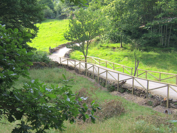
Castropol-Figueras coastal walk
- Castropol
- 8 km round trip
- 2 hours
- Download
The trail starts at the entrance of the village, where we will find a suitable place to leave the car. After a few meters we will find an information panel that will give us a general idea of the itinerary.
-
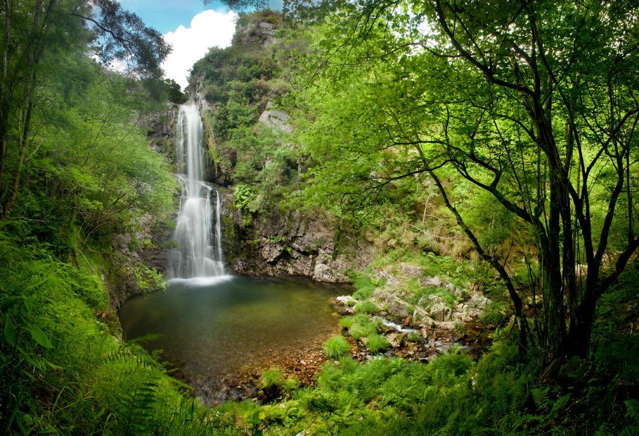
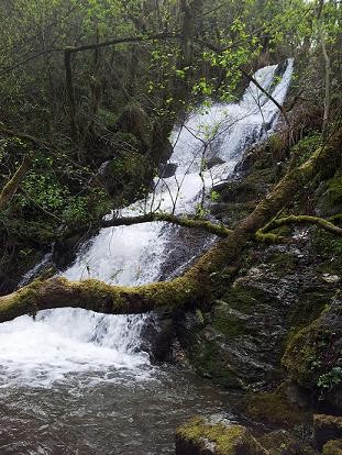
Cascada del Cioyo
- Castropol
- 3 km
- 1 - 2 horas
- Media
Escondida entre montañas y bosques del occidente asturiano, la Cascada del Cioyo es uno de esos lugares que parecen sacados de un cuento. El sonido del agua al caer, la vegetación exuberante que la rodea y la paz del entorno hacen de este rincón un destino ideal para quienes buscan conectar con la naturaleza. Una caminata entre árboles, pequeñas cascadas y paisajes que invitan a parar y respirar. Al final del recorrido, la gran cascada del Cioyo se abre paso con fuerza entre la roca, regalando una imagen de belleza salvaje difícil de olvidar.