
Ruta del Esqueicer
- Santa Eulalia de Oscos
- Ruta circular
- 8,6 Km
- 3 horas
- Media
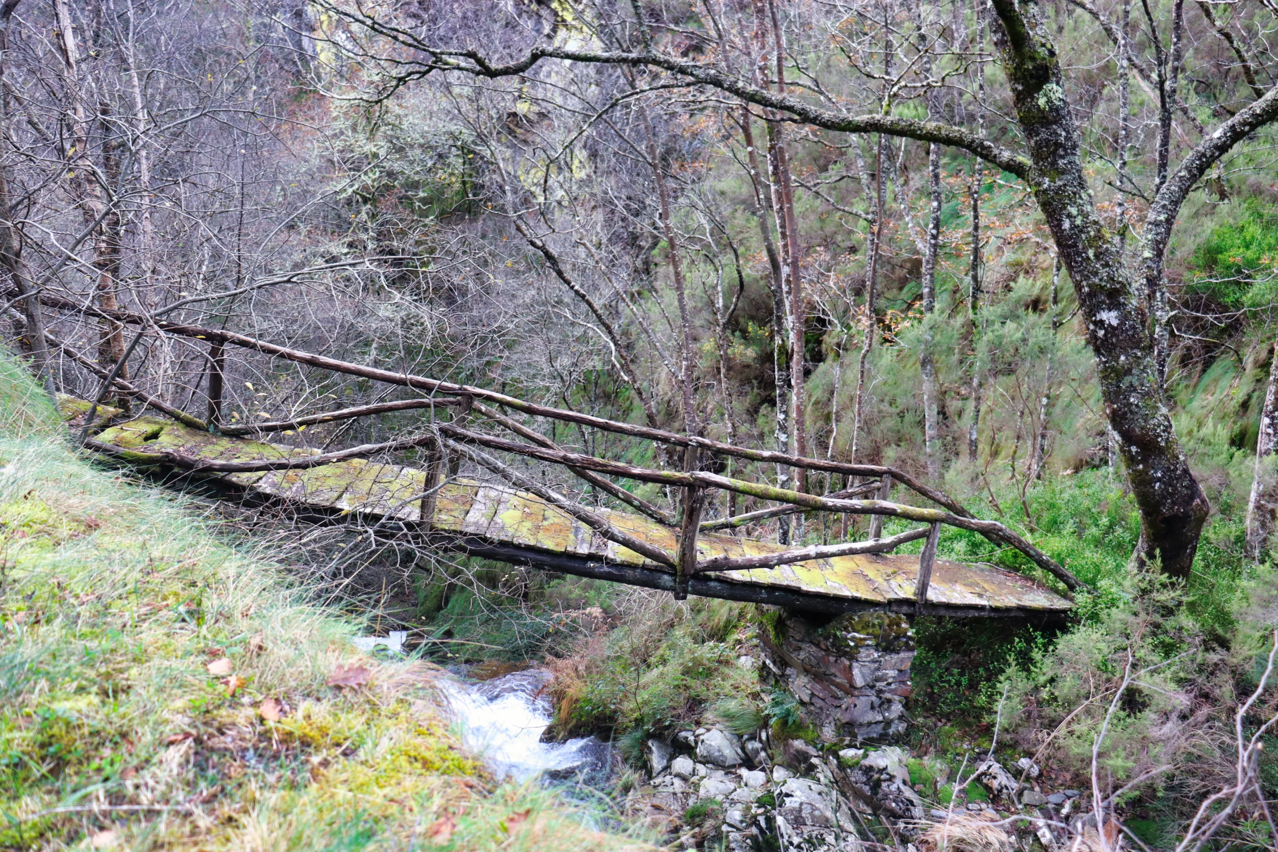
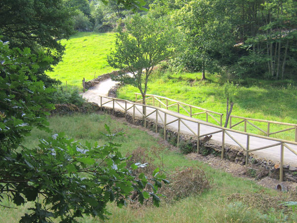
La ruta arranca en una curva situada entre el puente y la aldea de Sualleiro, justo al lado de los apartamentos que llevan ese mismo nombre. Inaugurada en agosto de 2020, se presenta bien cuidada y correctamente señalizada con flechas pintadas en árboles y piedras.
El primer tramo asciende suavemente por una pista cómoda, flanqueada por un muro de piedra a la derecha, mientras el río discurre en paralelo, unos metros más abajo. Tras esta subida inicial, el camino desciende y nos lleva hasta las ruinas de una antigua cabaña. Poco después, cruzamos un pequeño arroyo, que en épocas secas apenas lleva agua.
A través del arbolado se intuye un pequeño núcleo rural que dejaremos a la derecha tras recorrer un breve tramo de carretera. Giramos entonces a la izquierda para bordear el poblado por el otro lado y, al atravesar sus callejuelas, lo abandonamos ascendiendo por una pequeña cuesta que desemboca en una bifurcación.
Aquí tomamos el sendero de la derecha, en subida. El camino de la izquierda conduce a un pueblo abandonado, al que se puede visitar como desvío, regresando luego al cruce para continuar la ruta principal. La subida, larga y constante, culmina en el pueblo de Ventoso, el punto más elevado del recorrido.
Desde allí seguimos por carretera hasta casi el final del pueblo, donde giramos a la derecha para tomar una pista que bordea plantaciones de arándanos. Iniciamos entonces el descenso: tras salir de nuevo a la carretera, retomamos el sendero por un tramo de bajada, con algún cruce más hasta alcanzar una senda de tierra.
Finalmente, llegamos a la zona del puente. Entre dos casas, giramos a la derecha y, tras unos 50 metros por carretera, regresamos al punto de inicio donde se encuentra el cartel de la ruta, cerrando así este agradable paseo circular.
Hiking trails
-
Castropol-Figueras coastal walk
- Castropol
 8 km round trip
 2 hours
 Download
The trail starts at the entrance of the village, where we will find a suitable place to leave the car. After a few meters we will find an information panel that will give us a general idea of the itinerary.
-
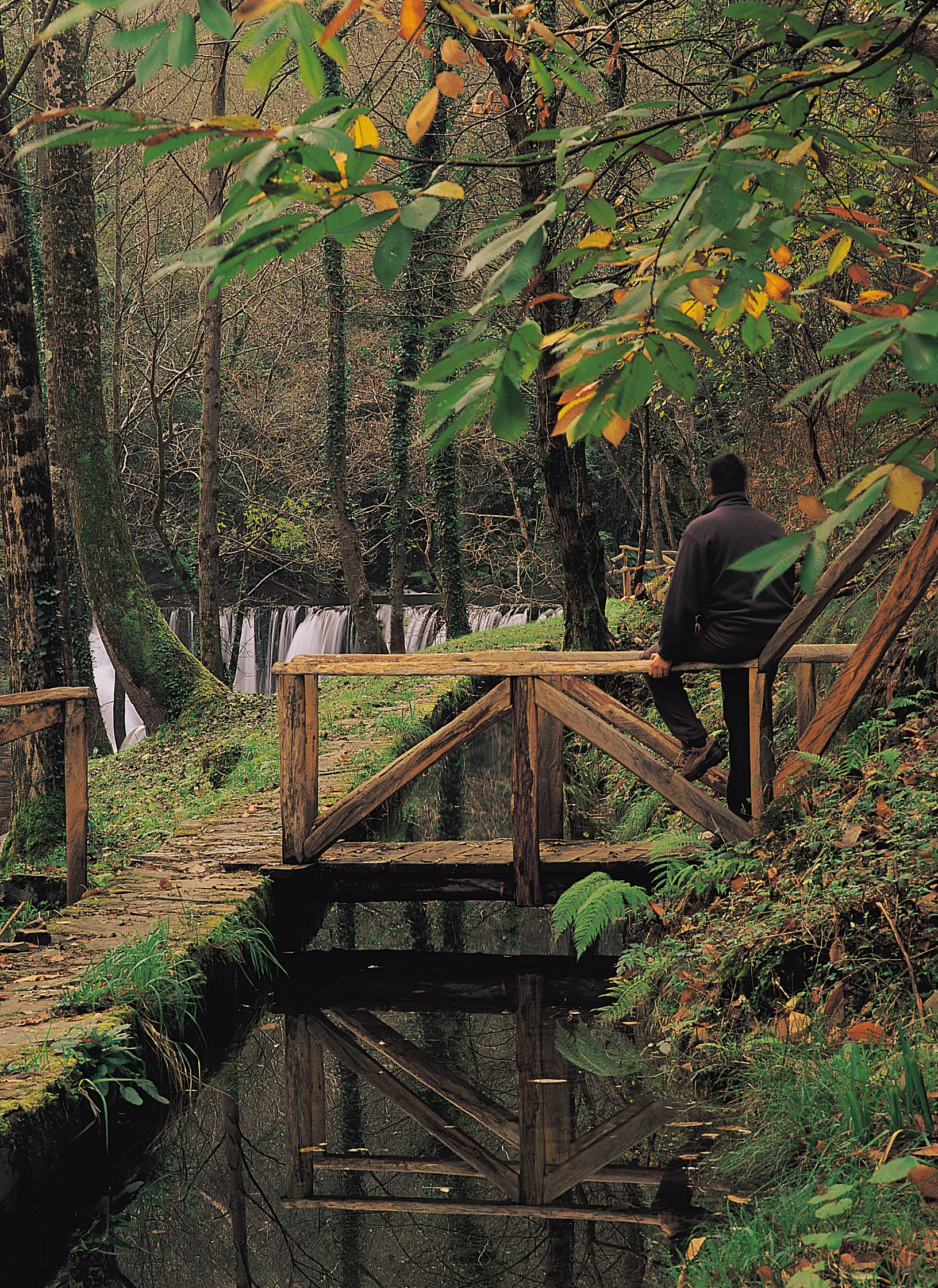
A Seimeira Route
- Santa Eulalia de Oscos
- 8 km round trip
- 3 hours
- Download
The route begins in the recreational area of Pumares; we cross the road and head parallel to the river to Pumares, a village of old ferreira activity, where we can still see the remains of an old mallet. From here, along a marked path, and leaving the river Agüeira to our left, we continue a slight ascent into a legendary forest characterized by riparian species (alders, ashes, willows, and hazelnut trees) and by oaks and chestnut trees that with their whimsical shapes are true monuments.
-
As Minas Greenway
- Vegadeo
- 13 km
- 4 hours
- Media
The route starts in the town of A Espía (Vegadeo) and is accessed through the AS-11 road that connects Vegadeo with Los Oscos.
-
Green path of San Martín de Oscos
- San Martín de Oscos
- 7.5 km
- 3 hours
- Download
This is a circular route of about 7.5 km that starts and ends in the village of San Martín de Oscos. We start the route next to the tourist office going up to A Bouza, where we will contemplate an exceptional view of the village.
-
Vegadeo – Vegadeo Route
- Vegadeo
- 26,089 Km.
- Download
Download the route in PDF and KML and follow the route with your mountain bike or MTB. With different levels of difficulty, duration, slope and length. If you don’t have a bike you can rent one.
-
Route of the “Estraperlo
- Vegadeo
- 8.2 km
- 2 hours and 30 minutes
- Download
The route begins in Louteiro, which is accessed after taking a detour to the left shortly before leaving Vegadeo in the direction of Galicia. From the chapel of this village begins the route once used by pilgrims and pilgrims on pilgrimage to Santiago de Compostela, who avoided the main roads to pass products from Galicia to Asturias.