
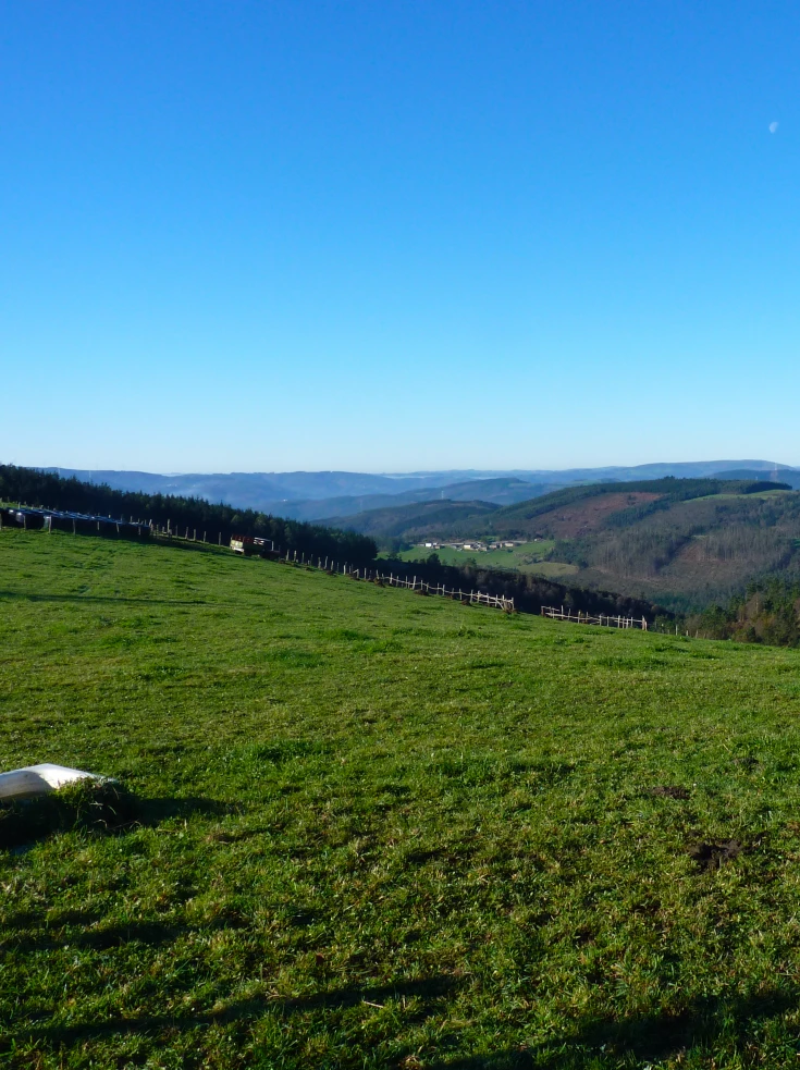
Vegadeo – Vegadeo Route
- Vegadeo
- MTB Route
- 26,089 Km.
- Download
Download the route in PDF and KML and follow the route with your mountain bike or MTB.
With different levels of difficulty, duration, slope and length.
If you don’t have a bike you can rent one.
Route with a mixed route, based on wide and local roads, which presents a very affordable route profile and with a high cyclability. It starts from the Town Hall Square of Vegadeo, to take the street of Armando Cotarelo, up passing in front of the birthplace of the Barcia Trelles. The street is steep and soon does not give the possibility of softening the pedaling, especially at the junction with the South Street, where we turn right passing in front of a beautiful fountain. We continue along the street ahead without leaving it, which leads us to a local road along which we continue climbing up to the pk. 1.2 where we turn left onto a track that goes into the ocalital of Mount Silvela, steeply sloping. It skirts halfway up the slope, glimpsing part of the town of Vegadeo and the AS-22 road. The section has a couple of important slopes, between which there are two important points, one is the track that comes from Piantón, and then we have the point where we leave the ascent to the mountain where the antenna is located, but it has no exit, so we must be attentive to turn off at Wp 9 or 10, in order to continue. Either of the two options Wp 9 or Wp 10, lead us to the junction of the road to Beldedo, where there is the possibility of returning to take water. At this point we continue along the main road for a stretch to turn off towards a house that we see a little lonely and below our lane. We turn off towards it, and once we have passed it we continue along the tracks of Concentración Parcelaria that Villametide that little by little take us towards the nucleus of Montouto, to which we go up a steep ramp. From Montouto we leave by its road until we reach the nucleus of Las Penelas, after gaining the hillock we join the road to Paraxe, to continue descending again by a wide track (Wp 20) whose source marks a lonely abandoned house. We descend to the Mountouto stream and cross it while closing the loop in the middle of large meadows, thus reaching the AS -11, which we cross taking a paved road that takes us almost flat to the chapel of San Lorenzo in Foxo. We continue until we cross the road that goes from Grandamea to the AS 11 and at the same crossroads we take a wide track a little to the left that, flat and heading north, skirts the Pico Agudelo until it ends at the hamlet of El Cobre, sharing this section of the route with the PR.AS de Mazo de Meredo. In El Cobre, we go down towards the chapel of San Pedro, and before arriving we take an asphalted branch that is on the right and soon becomes a wide track that winds all along the slope until it leads to a local road, we take the right branch that leads to the place of Areilo, where the PR.AS of Meredo forks. We follow the road until we reach the road that goes down to La Loureira (Samagán).
Hiking trails
-
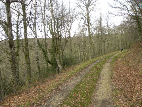
Mount Marón and Ascuita route
- San Martín de Oscos
 9 km
9 km 2 hours
 Download
We begin the route in San Martín de Oscos where we can see the parish church, with a Latin cross plan, large porticoed space and inscription of 1828. To the right of the facade we observe one of the most characteristic hórreos of the Oscos with a mixed roof (slate and straw), which corresponds to the primitive models. In front of the church we have the mansion of the Guzmanes, an old manor house of the XVIII century, which preserves in the portico of its main entrance a coat of arms carved in stone. We cross the bridge that crosses the San Martín river to begin the ascent to Mount Marón, entering a small forest of birch and oak trees, which make our walk even more pleasant.
-
Route of the “Estraperlo
- Vegadeo
- 8.2 km
- 2 hours and 30 minutes
- Download
The route begins in Louteiro, which is accessed after taking a detour to the left shortly before leaving Vegadeo in the direction of Galicia. From the chapel of this village begins the route once used by pilgrims and pilgrims on pilgrimage to Santiago de Compostela, who avoided the main roads to pass products from Galicia to Asturias.
-
As Minas Route
- Castropol
- 5 km
- 1 hour and a half
- low
The route starts in the town of Tol. At the crossroads of the church of San Salvador, follow the signs to the parking area Fontequias, in the vicinity of the neighborhood of Cabaleiros.
-
Ruta de Eiroá
- Taramundi
- 13 km
- 3h 50m
- Baja
Esta ruta circular recorre buena parte del valle del río Cabreira, combinando caminos de montaña en la ida y de fondo de valle en la vuelta. Se inicia junto al hotel La Rectoral, tomando el camino que asciende entre el arbolado hacia la Sierra de Eiroá. Sin llegar a alcanzar su cumbre nos desviamos hacia el pueblo de Piñeiro, para llegar a él en suave descenso y disfrutar de su arquitectura tradicional y cabazos alzados al cielo.
-
Carbayal de Salgueiras Route
- Villanueva de Oscos
- 7 km
- 2 hours
- Download
The itinerary begins next to the chapel of Salgueiras, located on the AS-27 road, 6 kilometers from Villanueva. Throughout the tour we must observe the environment around us: the houses, their attached buildings, orchards, meadows, farm implements, forests, to understand the way of life of the locals.
-
Railroad Route
- San Tirso de Abres
- 15 km
- 5 hours
- Download
We start the walk in the old station of San Tirso de Abres, today restored for private housing, finding the first of the six tunnels just 300 m away, continuing next to the river Eo enjoying every moment of great panoramic views of the riverbed, of incalculable ecological and fish value, in which abound a large number of aquatic species, the most characteristic being trout, lamprey and salmon. Later the path crosses the N-640 road and leads us to an old power station built in 1932, located just before crossing another of the tunnels drilled in the rock, which leaves us close to the pedestrian walkway over the river Eo.