
Mon Route
- San Martín de Oscos
- Circular route
- 12.6 km
- 4.5 hours
- Media
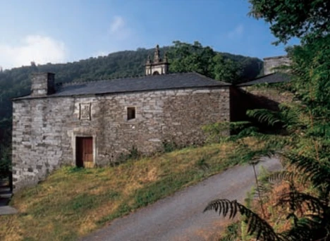
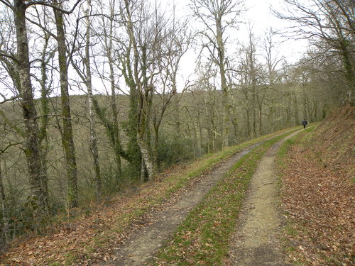
The itinerary begins in the village of A Revoqueira, three kilometers from San Martín.
This town is characterized by a well-preserved popular architecture and a gentle orography with green meadows, where numerous cows and their calves graze. Shortly after we will find the native forest (oak, chestnut and birch trees) that accompanies us until we reach Mon. Here the walker will be amazed by the majesty of the Palace of Mon, an example of baroque and stately architecture of the region. We continue the walk along a cart track bounded by stone walls and “chantos” (slate slabs driven) adorned with mosses and ferns to reach the chapel of Santa Marina, a place worth stopping and look out over the valley of the river Ahío in the background of which shines the Mazo de Mon. We continue the descent to the mallet through a lush and centenary chestnut grove dotted with “corripas” (circular stone constructions to store chestnuts), until we reach the hidden mallet of Mon. In this privileged natural space we find the remains of the Mazo, next to the old irrigation channel, still perfectly preserved today. At this point and before starting the way back, along the same path, we must stop to take a breath and enjoy the Ahío river and the ecosystem that surrounds it, characterized by riparian forest in which alders, ash and willows bathe their roots. Halfway up we turn left to Ventosa to return to Revoqueira.
Hiking trails
-
As Minas Route
- Castropol
 5 km
5 km 1 hour and a half
 low
low
The route starts in the town of Tol. At the crossroads of the church of San Salvador, follow the signs to the parking area Fontequias, in the vicinity of the neighborhood of Cabaleiros.
-
Forcón de los Ríos Route
- Santa Eulalia de Oscos
- 13.3 km
- 4 hours
- Media
Route of nature and ethnography that begins next to the house of culture in Santa Eulalia de Oscos.
-
Ruta Piorno a os Fornos
- San Martín de Oscos
- 5,5 km
- 2h 30m
- Baja
Iniciamos la ruta en el pueblo de Piorno, que se recomienda recorrer porque conserva excelentes muestras de arquitectura tradicional de los Oscos en piedra, pizarra y madera.
-
Carbayal de Salgueiras Route
- Villanueva de Oscos
- 7 km
- 2 hours
- Download
The itinerary begins next to the chapel of Salgueiras, located on the AS-27 road, 6 kilometers from Villanueva. Throughout the tour we must observe the environment around us: the houses, their attached buildings, orchards, meadows, farm implements, forests, to understand the way of life of the locals.
-
As Zarras Route
- Villanueva de Oscos
- 3.5 km
- 1 hour and 50 minutes
- Download
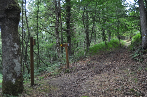
The route begins in Santa Eufemia, shortly after passing the Ecomuseo del Pan in the direction of Pacios. We enter a small path through a native forest populated by oak, birch, holly and chestnut trees.
-
Ouroso Route
- Taramundi
- 7.8 km
- 3 hours
- Download
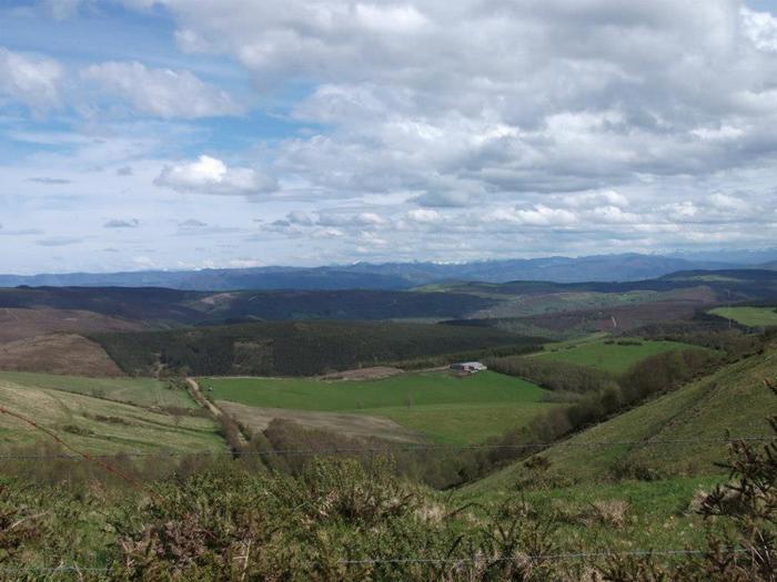
In the Teixo and just behind the hostel starts the forest track along which begins the walk to the Alto de Ouroso. The path is wide and passable by all-terrain vehicles, so there is hardly any possibility of getting lost. The route runs comfortably between wide pastures, heaths and pine forests of repopulation to reach a landing on which there is a small lagoon where at mid-morning many horses come to this point to water and refresh themselves in the shade of the pines. The animals graze in a semi-wild state and require little attention from their owners, which is why the number of horses has increased considerably in recent years.