
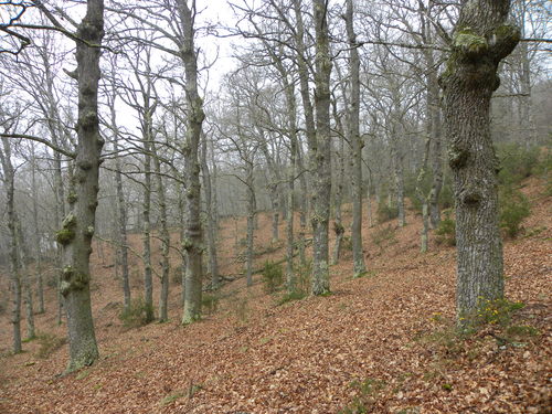
As Carballeiras Green Trail
- Santa Eulalia de Oscos
- Circular route
- 4.5 km
- 1 hour 20 minutes
- Download
This route starts at the Nature Interpretation Center, in the center of Santa Eulalia de Oscos.
After visiting the center observing the educational material that shows us the richness in flora, fauna and ethnography of the area, we can complement our information with a tour of the path that will help us to identify in a short time the different ecosystems and forests of the region. After a few meters we enter a characteristic mixed deciduous forest in which we find, among other species, oak, chestnut, birch and hazelnut trees. In the upper part of the forest gradually opens up and almost without noticing we are surrounded by scrub (heather, gorse, ferns and broom) that allows us a wide panoramic view overlooking the valley of the river Agüeira, which crosses the municipality in a NW-SE direction and the highest and most humanized areas of the municipality. In the descent to Pumares we pass by several meadows where it will not be difficult to see cows grazing accompanied by their young, meadows watered by the river Agüeira, which also feeds another characteristic type of forest, the riparian, which has a wide wealth and biodiversity formed by species such as alder, ash, willow or hazel. From Pumares we will return by our tracks to the crossroads, where we turn right and return to Santa Eulalia.
Hiking trails
-
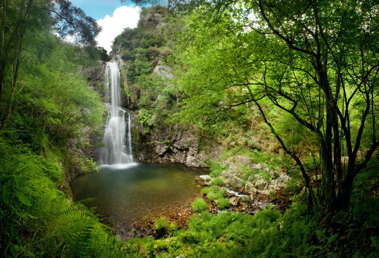
Cascada del Cioyo
- Castropol
 3 km
3 km 1 - 2 horas
 Media
Media
Escondida entre montañas y bosques del occidente asturiano, la Cascada del Cioyo es uno de esos lugares que parecen sacados de un cuento. El sonido del agua al caer, la vegetación exuberante que la rodea y la paz del entorno hacen de este rincón un destino ideal para quienes buscan conectar con la naturaleza. Una caminata entre árboles, pequeñas cascadas y paisajes que invitan a parar y respirar. Al final del recorrido, la gran cascada del Cioyo se abre paso con fuerza entre la roca, regalando una imagen de belleza salvaje difícil de olvidar.
-
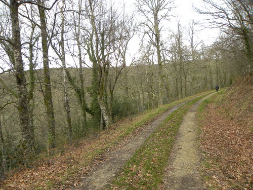
Carbayal de Salgueiras Route
- Villanueva de Oscos
- 7 km
- 2 hours
- Download
The itinerary begins next to the chapel of Salgueiras, located on the AS-27 road, 6 kilometers from Villanueva. Throughout the tour we must observe the environment around us: the houses, their attached buildings, orchards, meadows, farm implements, forests, to understand the way of life of the locals.
-
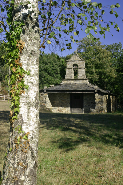
Mount Marón and Ascuita route
- San Martín de Oscos
- 9 km
- 2 hours
- Download
We begin the route in San Martín de Oscos where we can see the parish church, with a Latin cross plan, large porticoed space and inscription of 1828. To the right of the facade we observe one of the most characteristic hórreos of the Oscos with a mixed roof (slate and straw), which corresponds to the primitive models. In front of the church we have the mansion of the Guzmanes, an old manor house of the XVIII century, which preserves in the portico of its main entrance a coat of arms carved in stone. We cross the bridge that crosses the San Martín river to begin the ascent to Mount Marón, entering a small forest of birch and oak trees, which make our walk even more pleasant.
-
Vaguadas de Santa Eulalia de Oscos Route
- Santa Eulalia de Oscos
Download the route in PDF and KML and follow the route with your mountain bike or MTB.
-
Mon Route
- San Martín de Oscos
- 12.6 km
- 4.5 hours
- Media
The itinerary begins in the village of A Revoqueira, three kilometers from San Martín.
-
Castropol-Figueras coastal walk
- Castropol
- 8 km round trip
- 2 hours
- Download
The trail starts at the entrance of the village, where we will find a suitable place to leave the car. After a few meters we will find an information panel that will give us a general idea of the itinerary.