
As Minas Route
- Castropol
- Circular route
- 5 km
- 1 hour and a half
- low
The route starts in the town of Tol. At the crossroads of the church of San Salvador, follow the signs to the parking area Fontequias, in the vicinity of the neighborhood of Cabaleiros.
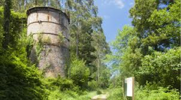
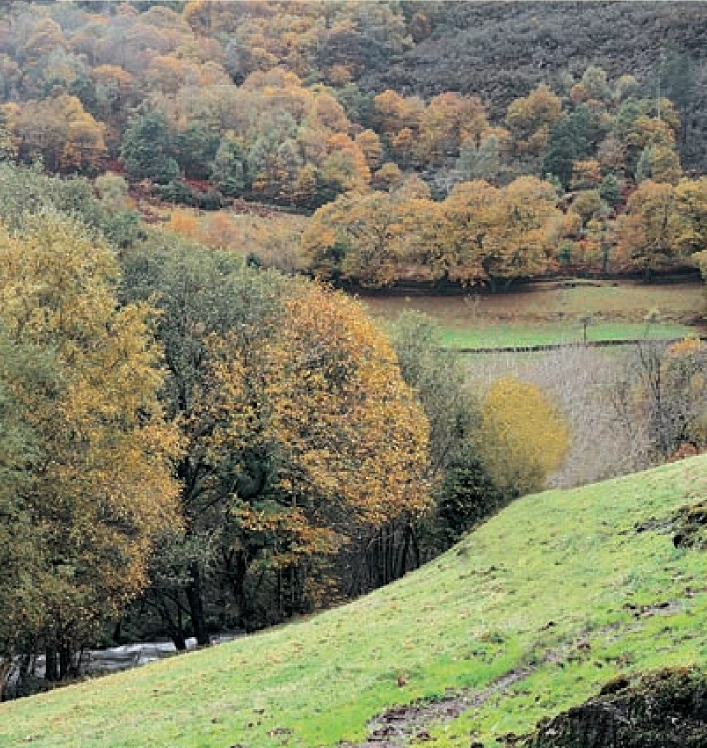
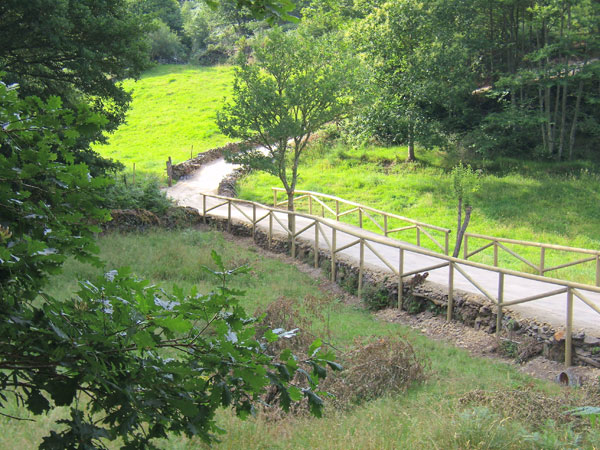
After leaving the vehicle, we head up the mountain on a paved road. On the way, we will see one of the most important cattle ranches in Asturias in terms of head of cattle, production and prizes. If you are interested in approaching it, the owners will be pleased to help you. Leaving the place of Boudois behind, we find a dirt road on the right that leads to the mine. At this point, the asphalt gives way to a nice path that runs through lush vegetation along the left bank of the Boudois stream. Turning right at the next crossroads we can see the remains of the furnace of the old iron mine. At this point an explanatory panel tells us some curiosities about it. We continue ascending to finally reach the top of Mount Arbedosa from where we can see a panoramic view that will undoubtedly surprise the traveler for its spectacular and chromatic variety. The blue of the coast blends with the green of the coast that appears tinted with black and white specks that make up small villages. It is worth stopping for a moment in Arbedosa and play to discover in the distance corners like Penarronda beach. From this point the route continues along an unpaved dirt track that descends to take us to the starting point.
Hiking trails
-
A Coba Route
- Santa Eulalia de Oscos
 14.5 km
 5 hours
 Medium - high
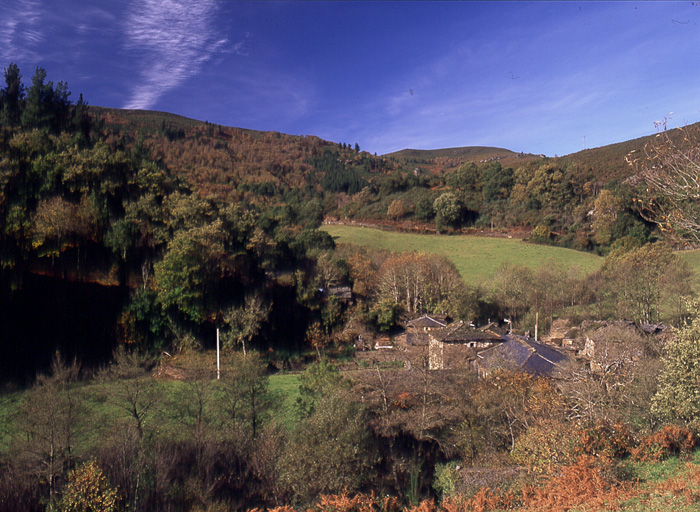
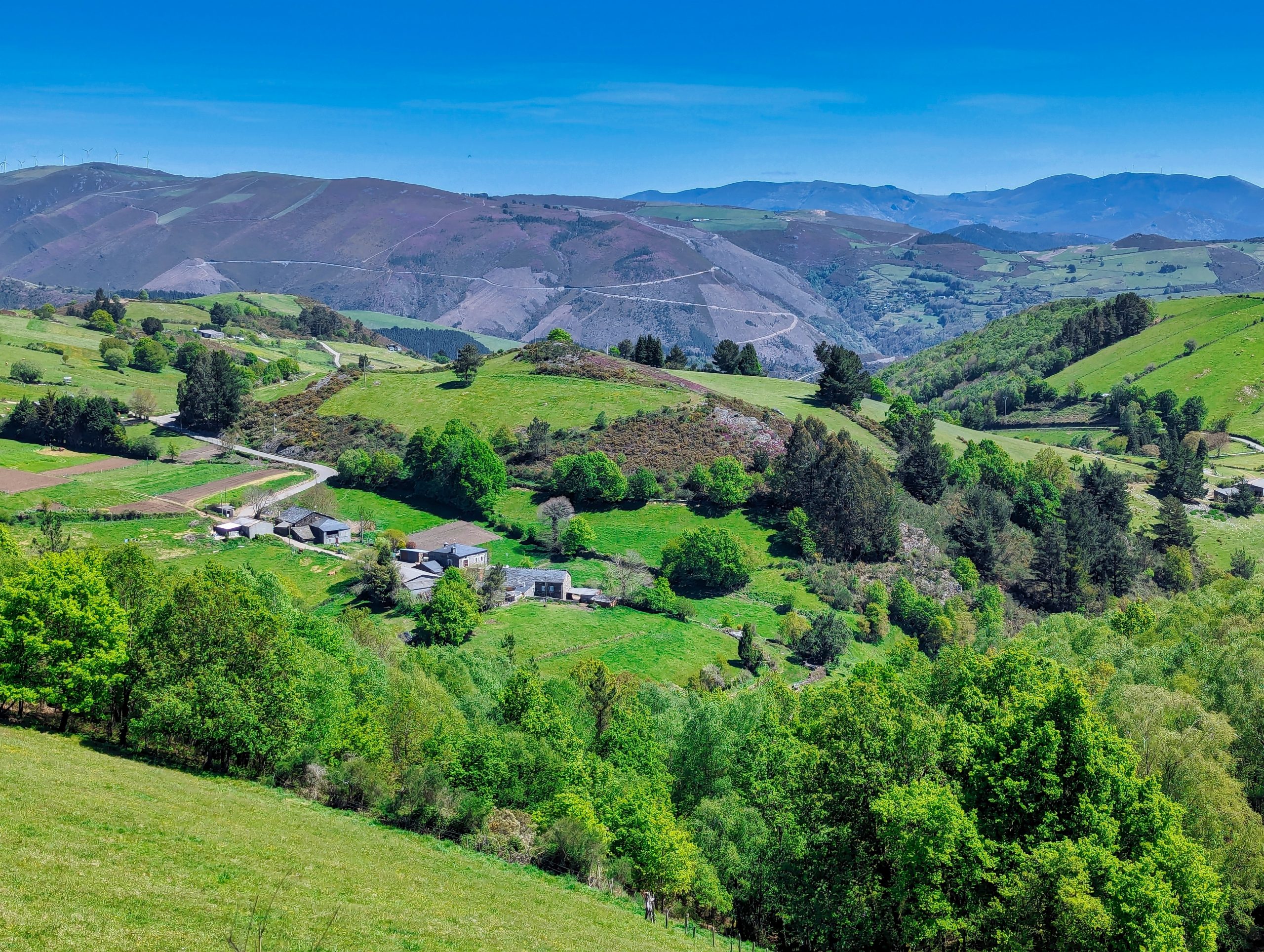
We start the route in the beautiful village of Ferreira, one of the best preserved of the municipality, where we can admire the popular architecture of the area while walking along its narrow paths in the shade of centuries-old vines.
-
Forcón de los Ríos Route
- Santa Eulalia de Oscos
- 13.3 km
- 4 hours
- Media
Route of nature and ethnography that begins next to the house of culture in Santa Eulalia de Oscos.
-
Route of the “Estraperlo
- Vegadeo
- 8.2 km
- 2 hours and 30 minutes
- Download
The route begins in Louteiro, which is accessed after taking a detour to the left shortly before leaving Vegadeo in the direction of Galicia. From the chapel of this village begins the route once used by pilgrims and pilgrims on pilgrimage to Santiago de Compostela, who avoided the main roads to pass products from Galicia to Asturias.
-
Green path of San Martín de Oscos
- San Martín de Oscos
- 7.5 km
- 3 hours
- Download
This is a circular route of about 7.5 km that starts and ends in the village of San Martín de Oscos. We start the route next to the tourist office going up to A Bouza, where we will contemplate an exceptional view of the village.
-
Ruta Piorno a os Fornos
- San Martín de Oscos
- 5,5 km
- 2h 30m
- Baja
Iniciamos la ruta en el pueblo de Piorno, que se recomienda recorrer porque conserva excelentes muestras de arquitectura tradicional de los Oscos en piedra, pizarra y madera.
-
Taramundi – Ouroso – Teixois – Veigas – Taramundi Route
- Taramundi
- 29,524 Km
Download the route in PDF and KML and follow the route with your mountain bike or MTB. With different levels of difficulty, duration, slope and length. If you don’t have a bike you can rent one.