
Eo estuary path
- Vegadeo
- Circular route
- 4.58 km
- 1 hour and a half
- Download
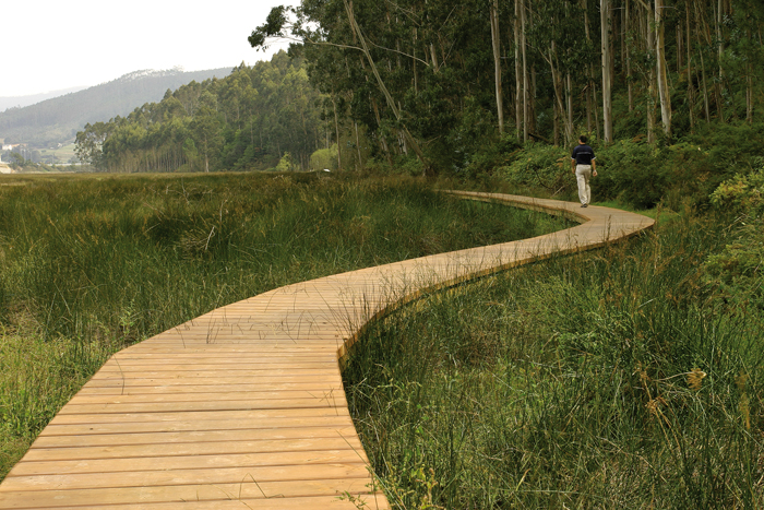
The route starts in the center of Vegadeo in the area known as the Fondrigo, located at the exit to Galicia. From here we start the ascent to Miou, where we will find a crossroads where the path forks and we can go on either side, since from this point the route is circular.
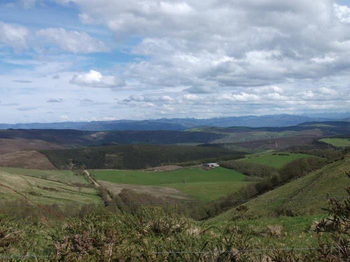
Suppose we decide to continue on the right, reaching shortly an area that allows us to see from above a beautiful view of the Eo estuary, a natural area included in the regional network of protected natural areas considered a Site of Community Interest (SCI), Special Protection Area for Birds (SPA), in addition to being part of the list of wetlands of international importance. We will continue along a dirt road perfectly conditioned reaching in a few meters a recreational area where we can rest or sit and enjoy the environment in which it will not be difficult to find some of the more than eighty species of birds recorded in the Eo estuary. From here and after a short descent we reach the pontoon area that will allow us to approach the estuary giving us the feeling of walking on the water especially at high tide. After a few meters we reach the jetty area, now recovered and equipped with wooden platforms that in summer time will be useful for sunbathing. Finally we cross Louteiro, we arrive at Miou, and from here to the starting point after having enjoyed a pleasant walk.
Hiking trails
-
Teixo – Os Teixois Route
- Taramundi
 10 km
10 km 3 hours and 45 minutes
 Media
Media
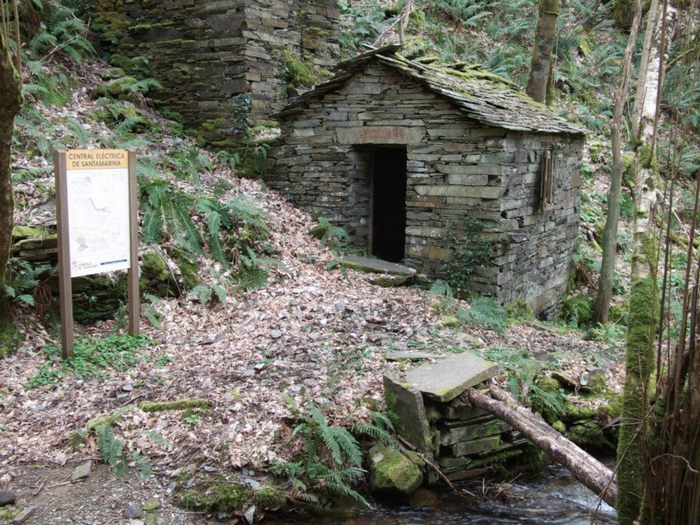
The itinerary begins in Teixo, where after leaving the vehicle and passing the last houses we start an easy walk along the road that connects this town with Santa Marina, leaving it to the right by a wide dirt track that leads us after a slight descent to the Arroyo das Mestas.
-
Route of the Muleteers
- San Tirso de Abres
- 15 km round trip
- 5 hours
- Download
To start the route we will move to the village of Espasande and half a kilometer from here in the direction of Taramundi we will see an explanatory panel on the left hand side at the beginning of the route.
-
Ruta Piorno a os Fornos
- San Martín de Oscos
- 5,5 km
- 2h 30m
- Baja
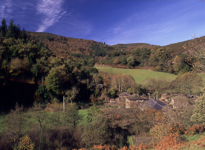
Iniciamos la ruta en el pueblo de Piorno, que se recomienda recorrer porque conserva excelentes muestras de arquitectura tradicional de los Oscos en piedra, pizarra y madera.
-
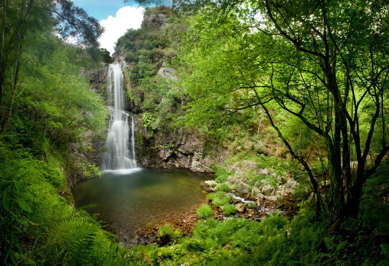
Cascada del Cioyo
- Castropol
- 3 km
- 1 - 2 horas
- Media
Escondida entre montañas y bosques del occidente asturiano, la Cascada del Cioyo es uno de esos lugares que parecen sacados de un cuento. El sonido del agua al caer, la vegetación exuberante que la rodea y la paz del entorno hacen de este rincón un destino ideal para quienes buscan conectar con la naturaleza. Una caminata entre árboles, pequeñas cascadas y paisajes que invitan a parar y respirar. Al final del recorrido, la gran cascada del Cioyo se abre paso con fuerza entre la roca, regalando una imagen de belleza salvaje difícil de olvidar.
-
Taramundi – Ouroso – Teixois – Veigas – Taramundi Route
- Taramundi
- 29,524 Km
Download the route in PDF and KML and follow the route with your mountain bike or MTB. With different levels of difficulty, duration, slope and length. If you don’t have a bike you can rent one.
-
Forcón de los Ríos Route
- Santa Eulalia de Oscos
- 13.3 km
- 4 hours
- Media
Route of nature and ethnography that begins next to the house of culture in Santa Eulalia de Oscos.