


7 hiking trails to enjoy the charm of Oscos-Eo

Redacción Oscos-Eo 08.04.2025
- Routes
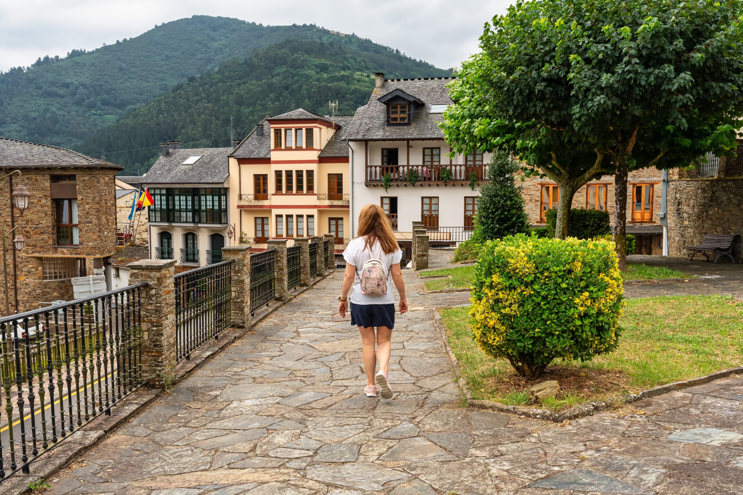
The Oscos-Eo region, Biosphere Reserve, Eo River, Oscos and Terras de Burón, offers visitors a wide variety of walking routes to enjoy the beauty of a unique landscape.
The first Biosphere Reserve in Spain shared between two Autonomous Communities is that of Río Eo, Oscos and Terras de Burón, an area that in Asturias extends from Castropol, facing the Cantabrian Sea to the gentle mountains of Santa Eulalia de Oscos.
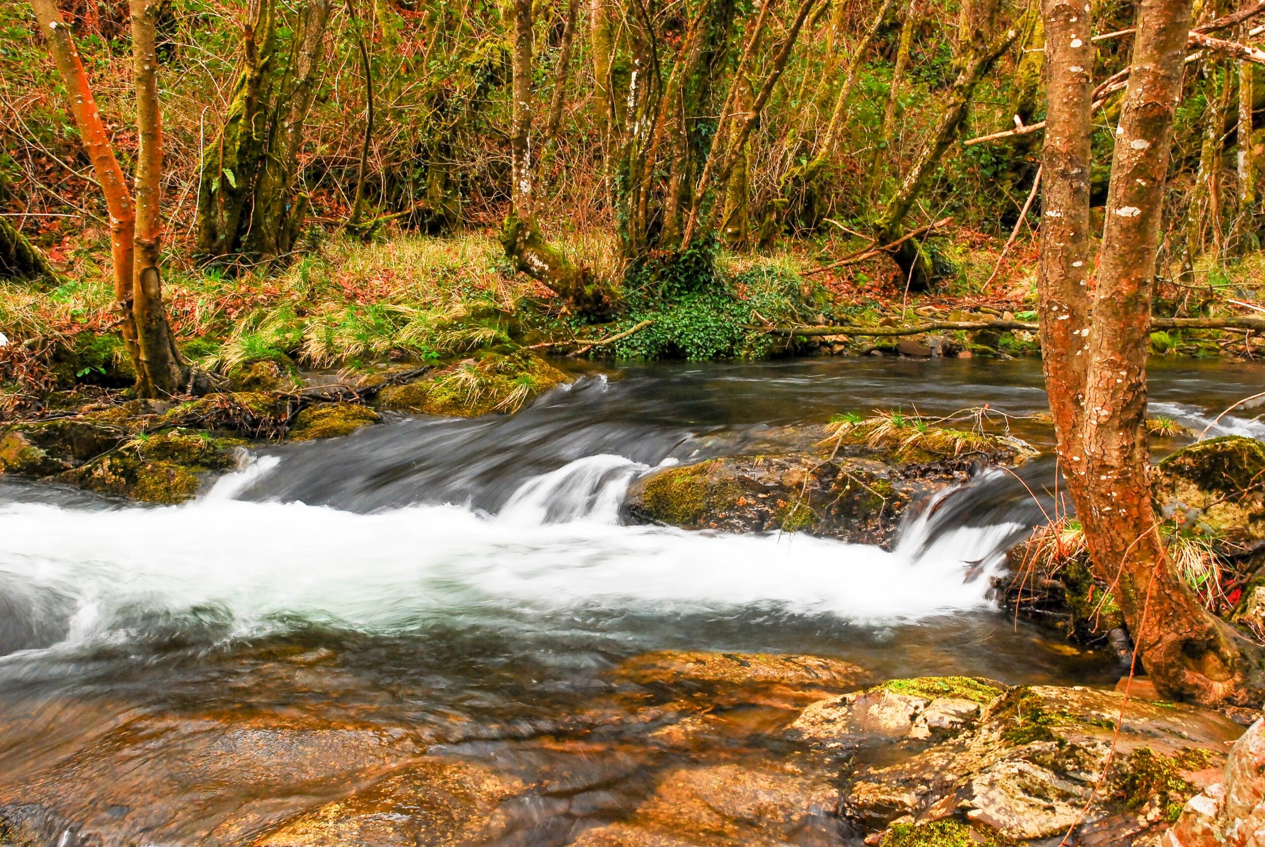
These gentle mountains are home to a large number of hiking trails, riversides, waterfalls or simply quiet landscapes where you can stroll under the branches of leafy chestnut and oak trees.
The rural Asturias, the one that goes from the “praos” to the small mountains, unfolds before the visitor in this region, without forgetting the surprise of finding on our way vestiges of man’s attempts to take advantage of Nature as a source of energy.
To better enjoy a getaway to Western Asturias, we present a small selection of five hiking trails in Oscos-Eo, simple and many of them suitable for families.
Railroad Route (San Tirso de Abres) PR – AS300
Active tourism in mountain biking or canoeing, sport fishing, a legendary waterfall (on the Pena del Encanto Route) or river landscapes are some of the charms of San Tiso, awarded Exemplary Town of Asturias (2011), where the Railway Route that communicated passengers and goods from the coast to the interior is located.
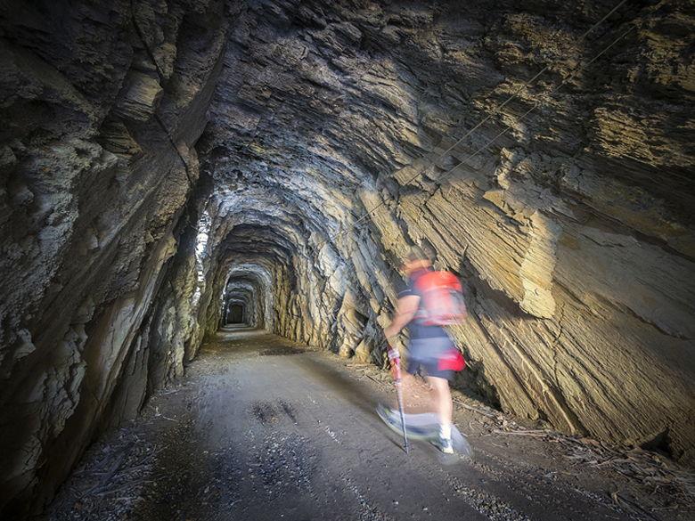
Railway route in San Tirso de Abres
The railroad was a symbol of progress in the 19th century, but between the end of the 20th century and the 21st century many of the routes, which linked small towns or industrial or mineral extraction areas, have been abandoned in favor of road transport.
This abandonment has also become a benefit for the traveler, since in places like San Tiso the old mining railroad that ran from 1903 to 1964 between Villaodrid and Ribadeo has become a comfortable hiking route.
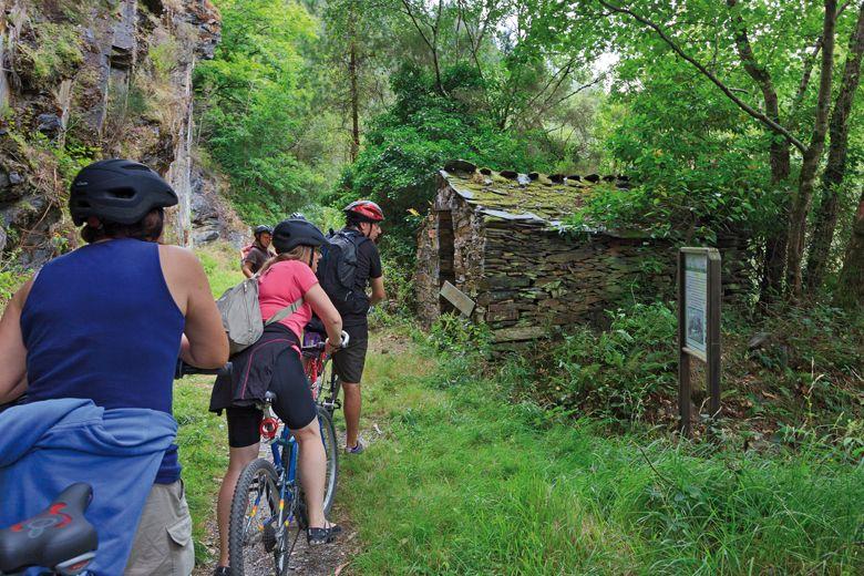
Cyclists on the Railway Route of San Tirso de Abres
The route, which enters Galicia, has hardly any unevenness and includes passing through several tunnels, an abandoned hydroelectric plant (although inside you can see part of the original machinery) and some bridges. A word of caution and a piece of advice: look both ways when crossing the N-640 road and take a flashlight with you, or do not go without a battery in your cell phone to use it, because not all tunnels have lighting (although they make up for it by being very wide and high).
Distance: 7 + 7 km
Time: 4 hours apx.
Difficulty: Easy
Starting point: Google Maps
Wikiloc: Route layout
Water Route (Taramundi) PR – AS17
Taramundi was a pioneer of rural tourism in Spain in the 80s of the twentieth century (some of you reading this would not have been born yet). It did not rest on its laurels, and continues to offer more than enough reasons to guarantee the success of a weekend getaway to this area: Taramundi’s famous knives have the Museum of Cutlery; the daily life of poor and well-to-do is reflected in the items on display at the Ethnographic Museum of Os Esquíos; in Os Castros there are the remains of a pre-Roman settlement, and the Museum of the Mills of El Mazonovo provides an insight into the importance of the water resource for the life and survival of the inhabitants, as well as the Ethnographic Complex Os Teixóis (with all kinds of traditional hydraulic devices in operation), where the Water Route ends, which I will explain below.
Water Route in Taramundi
We can leave the car in the parking lot above the Museum of the Mills of El Mazonovo (where there are 19 of them in operation), the largest of its kind in Spain. We follow the road for a few meters, after leaving it behind, before finding, well signposted, the slope that leaves it and where parallel to the Turia River we begin the route itself.
We will find a rest area very soon, when crossing the stony Escaderna Bridge, but I can’t figure out its usefulness if you do this route, unless you decide to do it the other way around (following the road – or a path as a greener option – to the Ethnographic Complex of Teixóis and returning to Taramundi through the interior).
There are three points that I consider of main interest on the route, the Salgueira waterfall (which makes us leave the route to see it and which was practically dry at the end of October, although it is a beautiful and neglected detour), Os Esquíos (where an artisan cutler survives), and Os Teixóis (ethnographic complex with flour mill, whetstone, power plant, fulling mill, mallet and forge).
Trail of the Taramundi Water Route
There is also the possibility of not going directly to Teixóis from Os Esquíos but to make a small detour to the village of As Veigas. Make the decision, depending on the time you have left on the route, in the shade and sitting in a small fountain at the fork.
Distance: 14 km
Time: 4.5 hours apx.
Difficulty: Easy
Starting point: Google Maps
Wikiloc: Route layout
Route of the Seimeira (Santa Eulalia de Oscos) PR- AS116
Exemplary Town of Asturias in 2016, along with San Martín and Villanueva de Oscos – given that this prized award was given to the three nuclei as a whole -, Santalla is home to the Sargadelos Museum’s Birthplace House Museum. Much more than a collection of items from his life, the house is a true and passionate look at daily life in the 18th century, with rooms that not only faithfully reproduce a kitchen or a bedroom, but many of its pieces are originals from the 19th and 20th centuries, explained by a guide who knows each of them, Iker, and their functions. And if you want to go a step further in understanding a traditional trade that barely survives in the 21st century, a visit to the smithy of the Ethnographic Ensemble of El Mazonovo is a must.
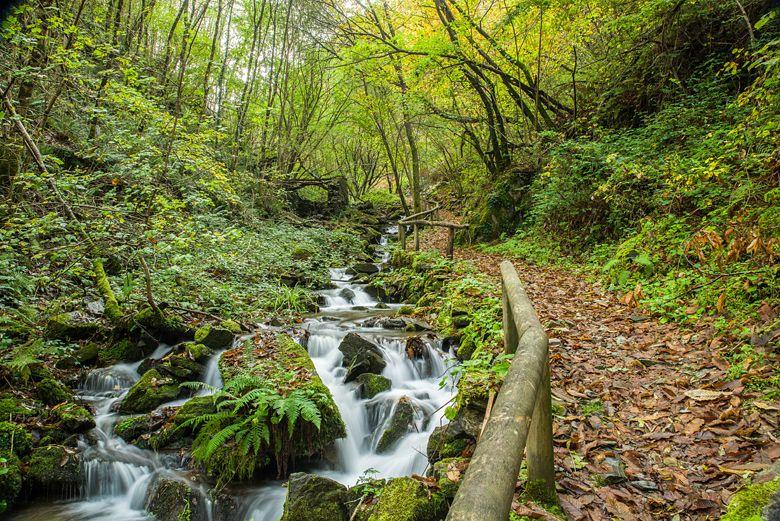
Route of the Seimeira in Santa Eulalia de Oscos
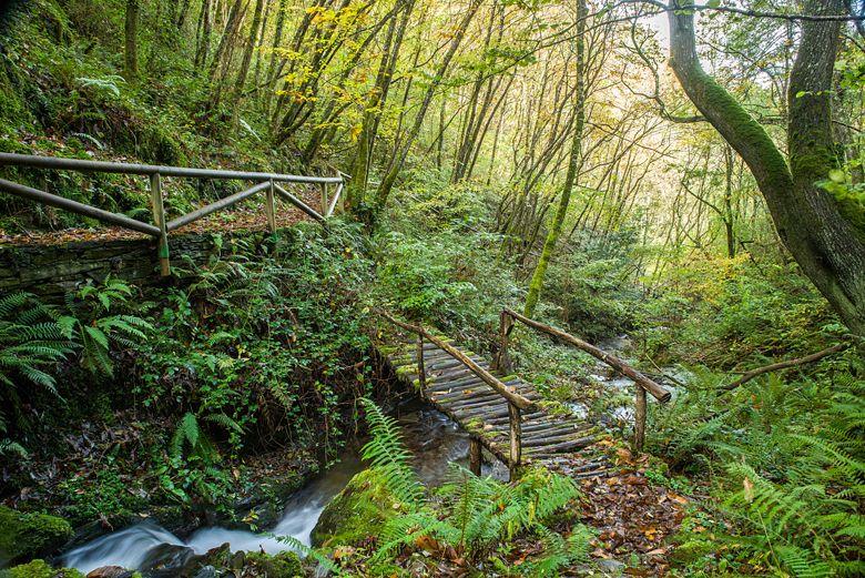
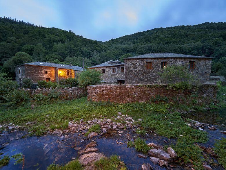
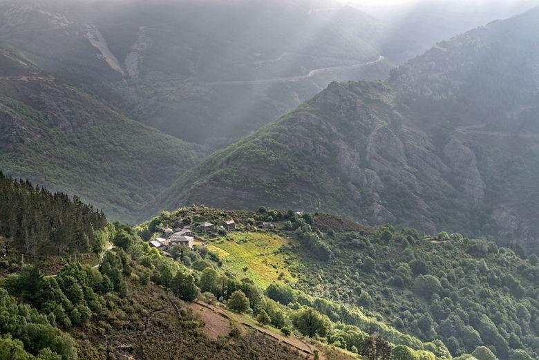
Pumares is a small rural nucleus of, like so many others in the region, stone houses and slate roofs. Almost exclusively dedicated to rural tourism, it is also the starting point of a route that brings together the three things that, separately or together, you can find when hiking in Oscos: a riverbed, remains of houses and a waterfall.
From Pumares we leave civilization by a path. Stone walls, protected today by mosses and ferns, and once protectors of the crop, will accompany us intermittently along the way. This mostly runs parallel to the Agüeira River, silent but not silent witness that in the now demolished village of A Ancadeira, which we will cross, and that once was inhabited.
Almost at the end of the road we can pause in the large recreational area of Valle del Desterrado. If you want to know the reason for its name, I will not reveal the reason or the tragic story behind it, but an information panel right there does.
Further on, a wooden bridge is the detour from the road to the village, also abandoned, of Busqueimado, 1.5 km away. I recommend going to see it on the way back from the waterfall, which is nearby, and only if we have time.
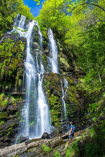
The Seimeira waterfall in Santa Eulalia de Oscos
About 300 m beyond this fork, the trail continues parallel to the river but among lush vegetation. The waterfall is first intuited by its sound and only when, navigating our way between stones, we finally find ourselves in front of its base, we can appreciate the 30 m of height.
For the more restless, and now entering the field of individual decision of each one, if you go back to the point where we were offered to reach Busqueimado there is a small improvised and unofficial trail that reaches the top of the lower of the two sections that make up the waterfall (you can therefore extend the route here and then return to the same point of diversion to continue the original route).
Maximum caution and watch your step if you decide to complete the route this way.
Distance: 6.5 km
Time: 3 hours apx
Difficulty: Easy
Starting point: Google Maps
Wikiloc: Complete route
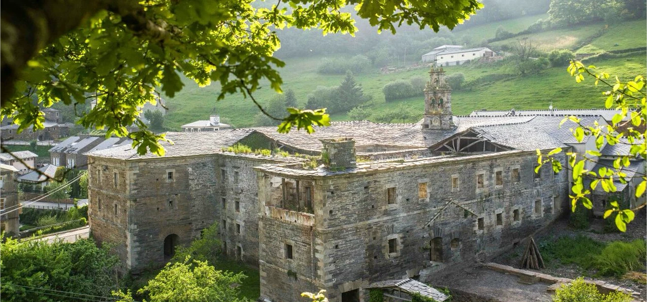
Silence Route (Villanueva de Oscos) PR – AS209
Exemplary Village of Asturias in 2016 – along with Santa Eulalia and San Martín de Oscos – Villanueva de Oscos has one of the most beautiful and best located monasteries I have seen in a long time. A baroque building where its facade and walls are impressive, and which can be visited, with the added advantage that throughout the year various cultural events and festivals are organized there such as the Festa dos frailes, or concerts of all kinds, theatrical performances, street market, etc.. In short, Villanueva is an example of an ancient monastery with contemporary uses.
Route of Silence in Villanueva de Oscos
Also in Villanueva de Oscos you can visit the facilities of several old iron and gold mines, an Ecomuseum of Bread, geocaching and hiking trails, such as the Ruta del Silencio.
Town of San Cristobal on the Silence Route
The silence referred to in the circular route is not broken even by the modern windmills that we will find on the surrounding peaks at the beginning of the route. The silence begins with the starting point of the route, the semi-abandoned village of San Cristuebu.
Although we can leave the car at the indicated point further on (if you have an SUV, it is an ideal moment to take advantage of its height above the ground and drive it up to the “sidewalk”), it is possible that you will not walk alone, as a couple of affectionate dogs will accompany you even beyond the village chapel.
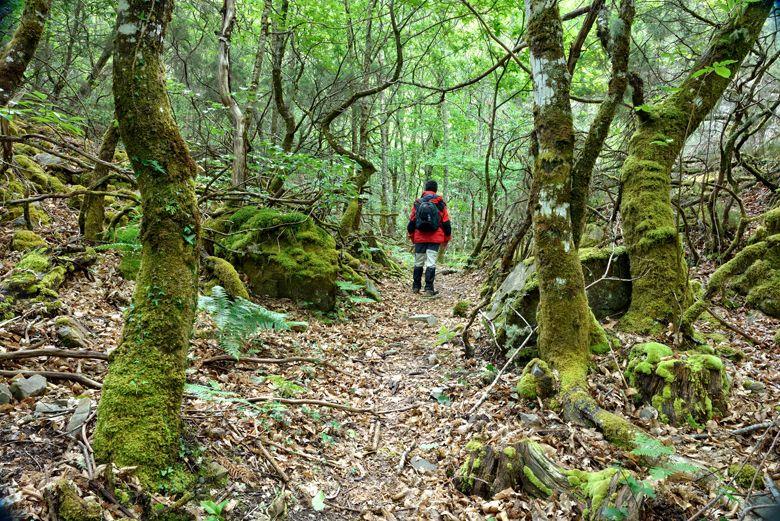
Under birch and oak trees, walking through the foothills of the Sierra de la Bobia mountains that surround the village, the highest point of this route is the 811 m of the Pico de Balongo, a beautiful vantage point overlooking the surrounding nature.
I have indicated, and more people do, as “difficult” this route only for a couple of sections of steep climbs and descents. Some will find it rather “complicated” and for others it will be “moderate”, but I prefer to err on the side of safety when qualifying it.
Distance: 12 km
Time: 5.5 hours apx
Difficulty: Difficult
Starting point: Google Maps
Wikiloc: Route layout
Mon Route (San Martín de Oscos) PR- AS114
Exemplary Town of Asturias in 2016, with (along with Santa Eulalia and Villanueva de Oscos, among the rural peace and quiet landscapes that San Martín de Oscos offers to the visitor, I would like to highlight a beautiful building. The Mon Palace, from the XVIII century, is a majestic stone ensemble in a small settlement, guarded by its coats of arms and a legend. A visit can be arranged through the Tourist Office, which will also serve as an excuse to start the Mon Route.
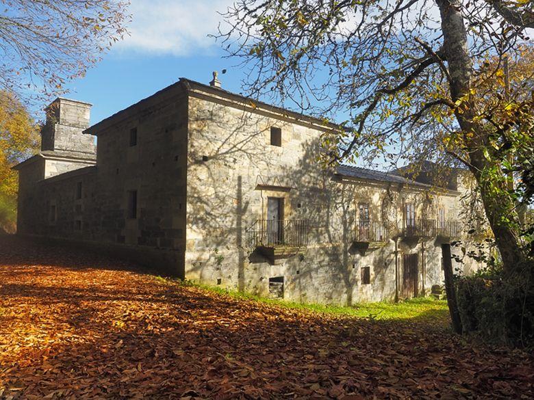
Mon Palace in San Martín de Oscos
Depending on the time available, this route has three possible starting points: Samartín (capital of the council), A Reboqueira or Mon itself.
When I did it, because the landscape between San Martín de Oscos and A Reboqueira were cultivated meadows, and because the section between A Reboqueira and Mon could be done by road and shortened (to enjoy more other sections), I started it in Mon.
Just before reaching the village, at the end of a straight road, there is a small parking area. Down the road you enter the village of Mon, literally four houses and a closed palace (one building but two architectural ensembles, from the sixteenth and eighteenth century) of private ownership.
Mon Route in San Martín de Oscos
After crossing the village, a fork in the road offers the possibility of continuing to the Mazo de Mon (1.5 hours i / v) but first it is advisable to take the other option, to the nearby Ermita de Santa Marina, the oldest of the council.
The small detour leads us to the humble village chapel. Protected its access by wooden railings, we find it collected, although slapped by the elements and by the uncivilized who only know how to remember its name if they carve it in the wood.
We return to the path but not before glimpsing the first views, if a sea of fog does not cover them, towards small villages in the mountains as Francos or Pesoz. The path is protected by natural barriers of ferns and artificial barriers of “chantos” (stone slabs nailed to the ground), so don’t be in a hurry to reach the end and enjoy the walk.
Distance: 12 km (from A Reboqueira)
Time: 5 hours apx
Difficulty: Difficult
Starting point: Google Maps
Wikiloc: Route layout
Eo estuary path
The route starts in the center of Vegadeo in the area known as the Fondrigo, located at the exit to Galicia. From here we start the ascent to Miou, where we will find a crossroads where the path forks and we can go on either side, since from this point the route is circular.
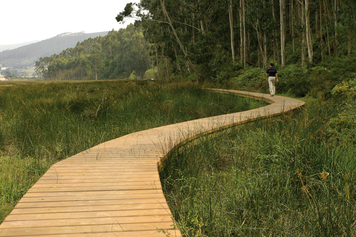
Eo estuary path (Vegadeo)
Suppose we decide to continue to the right, soon reaching an area that allows us to see from the top a beautiful view of the Eo estuary, a natural area included in the regional network of protected natural areas considered a Site of Community Interest (SCI), Special Protection Area for Birds (SPA), as well as being part of the list of wetlands of international importance.
We will continue along a dirt road perfectly conditioned reaching in a few meters a recreational area where we can rest or sit and enjoy the environment in which it will not be difficult to find any of the more than eighty species of birds recorded in the Eo estuary. From here and after a short descent we reach the pontoon area that will allow us to approach the estuary giving us the feeling of walking on the water especially at high tide.
After a few meters of road we arrive at the area of the pier, now recovered and equipped with wooden platforms that in summer times will serve us to sunbathe. Finally we cross Louteiro, we arrive at Miou, and from here to the starting point after having enjoyed a pleasant walk.
Distance: 4.58 km
Time: 1 hour and a half
Difficulty: Low
Type: Circular route
Starting point: Google Maps
PDF: Download the route in PDF
Castropol-Figueras coastal walk
The trail starts at the entrance of the village, where we will find a suitable place to leave the car. After a few meters we will find an information panel that will give us a general idea of the itinerary.
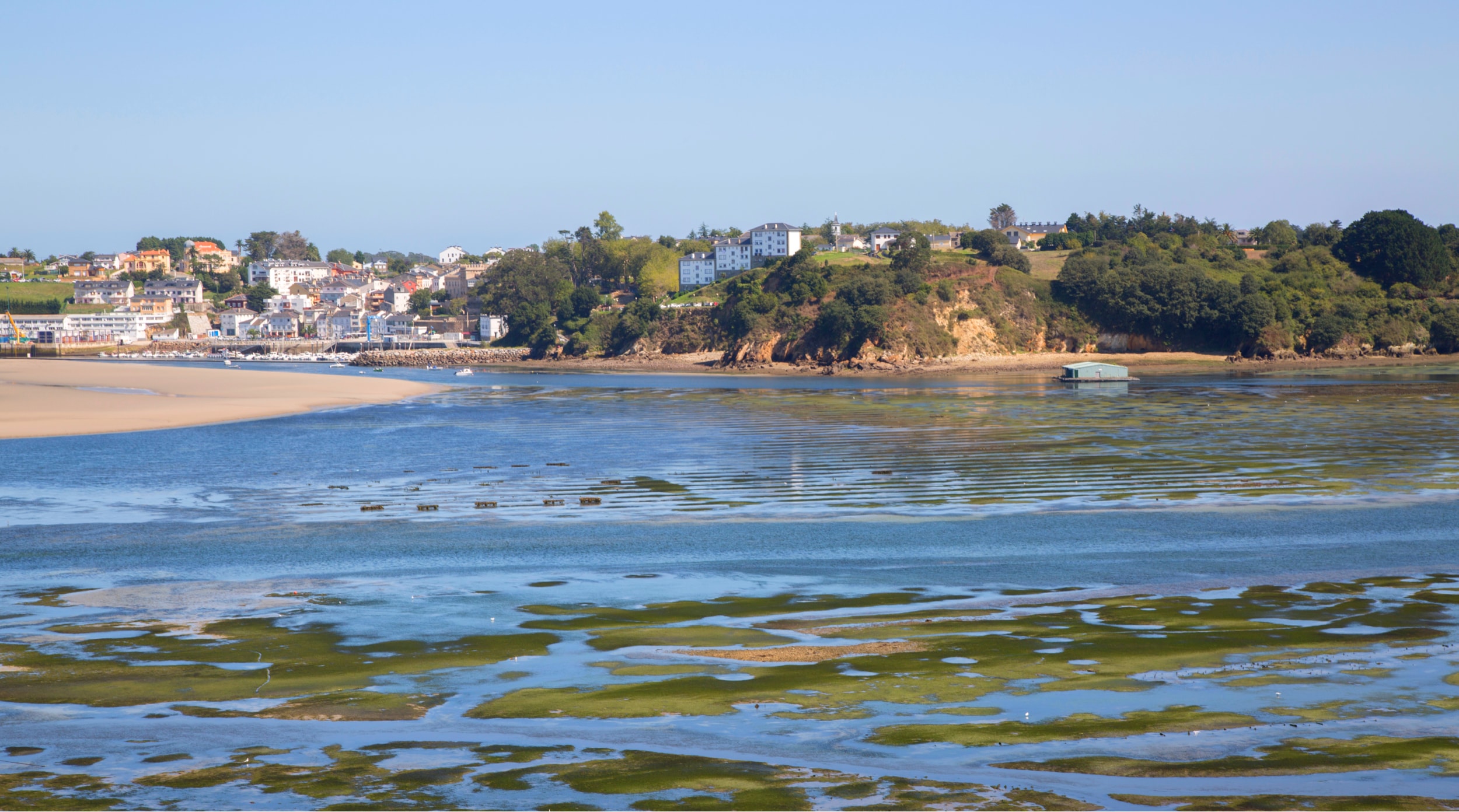
Views of Figueras from Castropol
We continue until we reach Salías, from here we can see a large part of the Linera inlet, Castropol on the left side, Figueras on the right side and in the background Ribadeo and the bridge of Los Santos; the islet of Turullón with its unique silhouette. At low tide you can see the oyster and mollusc crops of the Eo estuary. Spectacular is the contrast offered by the blue of the estuary with the green meadows that surround it.
Our next stop is the Esquilo viaduct where we find a small carpentry of Ribera. The only survivor of the many that once existed in the area, dedicated to the construction of fishing boats. Behind it, the inlet of the Linera is the contrast that offers a fantastic panoramic view. And a little further on we will go back in time to contemplate the remains of the mill of As Acías, an old tide mill. In the vicinity of the same two small coves offer us the possibility of a bath.
We finish the route in Figueras, a unique fishing village that deserves a visit. The way back runs through the same place, if we are tired and it is summer we have the possibility of returning by boat.
Distance: 8 km round trip
Time: 2 hours
Difficulty: Low
Type: Linear route
Starting point: Google Maps
PDF: Download the route in PDF
Wikiloc: Route layout
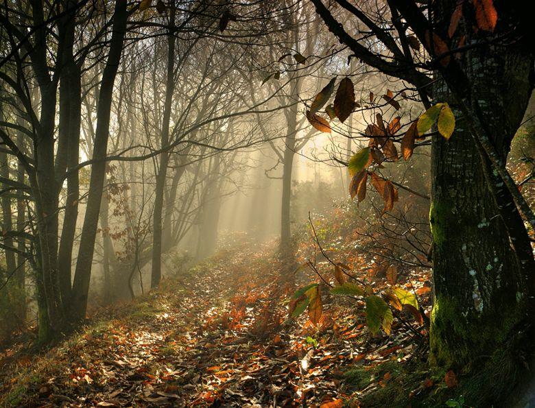
Chestnut trees, oaks, beeches, birches and the sound of water flowing through streams, with the occasional remains of crumbling stone houses, will be our companions in the hiking trails in the Oscos-Eo region.
This area of Asturias, which embraces Galicia on the Eo River, offers visitors gentle and peaceful landscapes for a getaway that includes, of course, visits to ethnographic sites to better understand the life of those who live among these mountains.
More from the Blog
-
- 08.04.2025
- By Redacción Oscos-Eo
Top 10 things to see and do in Los Oscos
The Oscos are three in one: Santa Eulalia, San Martín and Villanueva. Three peaceful places with dozens of options to enjoy your vacation. Here we suggest 10 irresistible plans.
-
- 08.04.2025
- By Redacción Oscos-Eo
History
The region of Oscos-Eo, located in the extreme west of Asturias, is a corner where time seems to walk to the rhythm of the ancient ferreiros and the serene waters of the Eo.