
Route of the Mazo de Meredo
- Vegadeo
- Circular route
- 13 km
- 4 hours
- half
The route starts in Piantón, a charming village that was once the capital of the council, located about two kilometers from Vegadeo in which we recommend a walk around the square and a visit to the church. We cross the so-called Roman Bridge and take the path to the left towards Arcilo. The path begins with a slight ascent through a deep eucalyptus forest mixed with remnants of native vegetation: chestnut, holly, laurel, … fed by numerous streams.
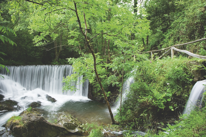
Arrived at Arcilo we turn off to the right continuing the road to Cobre, where we will find two possibilities to reach Meredo: a more direct way of 1.5 km and another of 3.5 km passing through El Foxo. Already in the area of Meredo we will descend until we reach the Mazo, where we can take the opportunity to regain strength in the recreational area that surrounds it and get closer to the tradition of iron and the use of water power by observing the mallet and the mill. Returning to the path again, we head for Arcilo, accompanied throughout the route by the Suarón River, which pours its waters tirelessly into the Eo estuary, noted for its important ecological and ornithological value. The route runs very close to the mansion of Sestelo, an emblematic building of the region. On the way back to Piantón we will have a good view of the valley, a very humanized landscape where we will be able to see meadows, farmland, reforestation, etc.
Hiking trails
-
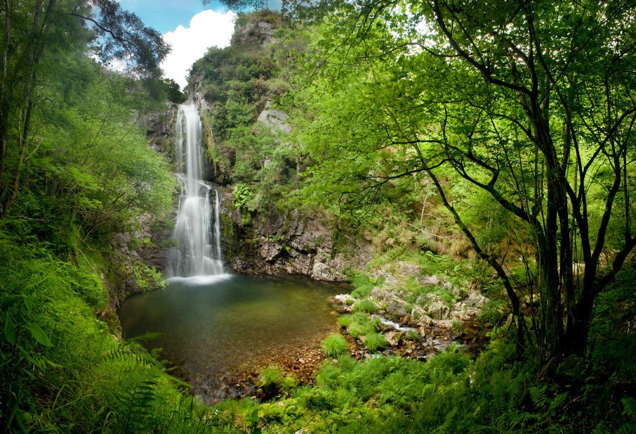
Cascada del Cioyo
- Castropol
 3 km
3 km 1 - 2 horas
 Media
Media
Escondida entre montañas y bosques del occidente asturiano, la Cascada del Cioyo es uno de esos lugares que parecen sacados de un cuento. El sonido del agua al caer, la vegetación exuberante que la rodea y la paz del entorno hacen de este rincón un destino ideal para quienes buscan conectar con la naturaleza. Una caminata entre árboles, pequeñas cascadas y paisajes que invitan a parar y respirar. Al final del recorrido, la gran cascada del Cioyo se abre paso con fuerza entre la roca, regalando una imagen de belleza salvaje difícil de olvidar.
-
Forcón de los Ríos Route
- Santa Eulalia de Oscos
- 13.3 km
- 4 hours
- Media
Route of nature and ethnography that begins next to the house of culture in Santa Eulalia de Oscos.
-
Water Route
- Taramundi
- 14 km
- 4 hours and 30 minutes
- Download
Its fourteen kilometers allow us to enjoy the water and its use for centuries in the rural environment. From the lower part of Taramundi we take a road that leads us to Mazonovo, where we can visit the Museum of Mills.
-
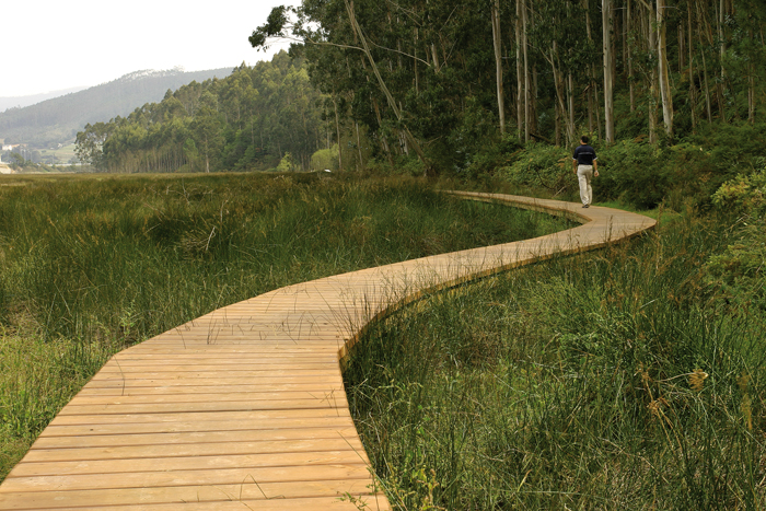
Eo estuary path
- Vegadeo
- 4.58 km
- 1 hour and a half
- Download
The route starts in the center of Vegadeo in the area known as the Fondrigo, located at the exit to Galicia. From here we start the ascent to Miou, where we will find a crossroads where the path forks and we can go on either side, since from this point the route is circular.
-
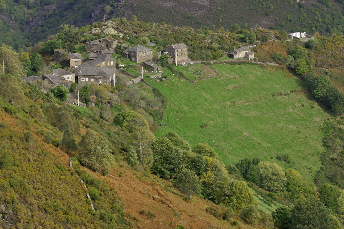
Route of Silence
- Villanueva de Oscos
- 12 km
- 5 hours
- High
The route starts in San Cristobal, a place where we find numerous samples of popular architecture in its purest state, giving us the sensation of having gone back several centuries in time. From its chapel we see the valley of Rio Ahio covered with a beautiful blanket of native forest that dazzles us with its typical colors.
-
Railroad Route
- San Tirso de Abres
- 15 km
- 5 hours
- Download
We start the walk in the old station of San Tirso de Abres, today restored for private housing, finding the first of the six tunnels just 300 m away, continuing next to the river Eo enjoying every moment of great panoramic views of the riverbed, of incalculable ecological and fish value, in which abound a large number of aquatic species, the most characteristic being trout, lamprey and salmon. Later the path crosses the N-640 road and leads us to an old power station built in 1932, located just before crossing another of the tunnels drilled in the rock, which leaves us close to the pedestrian walkway over the river Eo.