
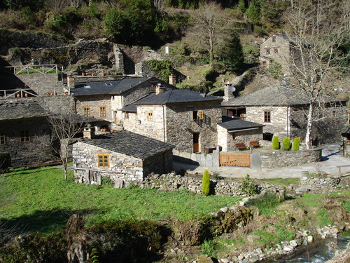
Balcones de Villanueva de Oscos Route
- Villanueva de Oscos
- MTB Route
- 25,272 Km
- 5 hours
- Download
Download the route in PDF and KML and follow the route with your mountain bike or MTB.
With different levels of difficulty, duration, slope and length.
If you don’t have a bike you can rent one.
Route with a mixed route, based on wide and local roads, which presents a very affordable route profile and with a high cyclability. It starts from the Town Hall Square of Vegadeo, to take the street of Armando Cotarelo, up passing in front of the birthplace of the Barcia Trelles. The street is steep and soon does not give the possibility of softening the pedaling, especially at the junction with the South Street, where we turn right passing in front of a beautiful fountain. We continue along the street ahead without leaving it, which leads us to a local road along which we continue climbing up to the pk. 1.2 where we turn left onto a track that goes into the ocalital of Mount Silvela, steeply sloping. It skirts halfway up the slope, glimpsing part of the town of Vegadeo and the AS-22 road. The section has a couple of important slopes, between which there are two important points, one is the track that comes from Piantón, and then we have the point where we leave the ascent to the mountain where the antenna is located, but it has no exit, so we must be attentive to turn off at Wp 9 or 10, in order to continue. Either of the two options Wp 9 or Wp 10, lead us to the junction of the road to Beldedo, where there is the possibility of returning to take water. At this point we continue along the main road for a stretch to turn off towards a house that we see a little lonely and below our lane. We turn off towards it, and once we have passed it we continue along the tracks of Concentración Parcelaria that Villametide that little by little take us towards the nucleus of Montouto, to which we climb a steep ramp. From Montouto we leave by its road until we reach the nucleus of Las Penelas, after gaining the hillock we join the road to Paraxe, to continue descending again by a wide track Wp 20 at the height of a lonely abandoned house.
Hiking trails
-
As Minas Route
- Castropol
 5 km
5 km 1 hour and a half
 low
low
The route starts in the town of Tol. At the crossroads of the church of San Salvador, follow the signs to the parking area Fontequias, in the vicinity of the neighborhood of Cabaleiros.
-
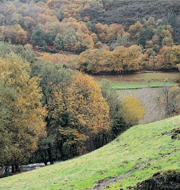
Route of Silence
- Villanueva de Oscos
- 12 km
- 5 hours
- High
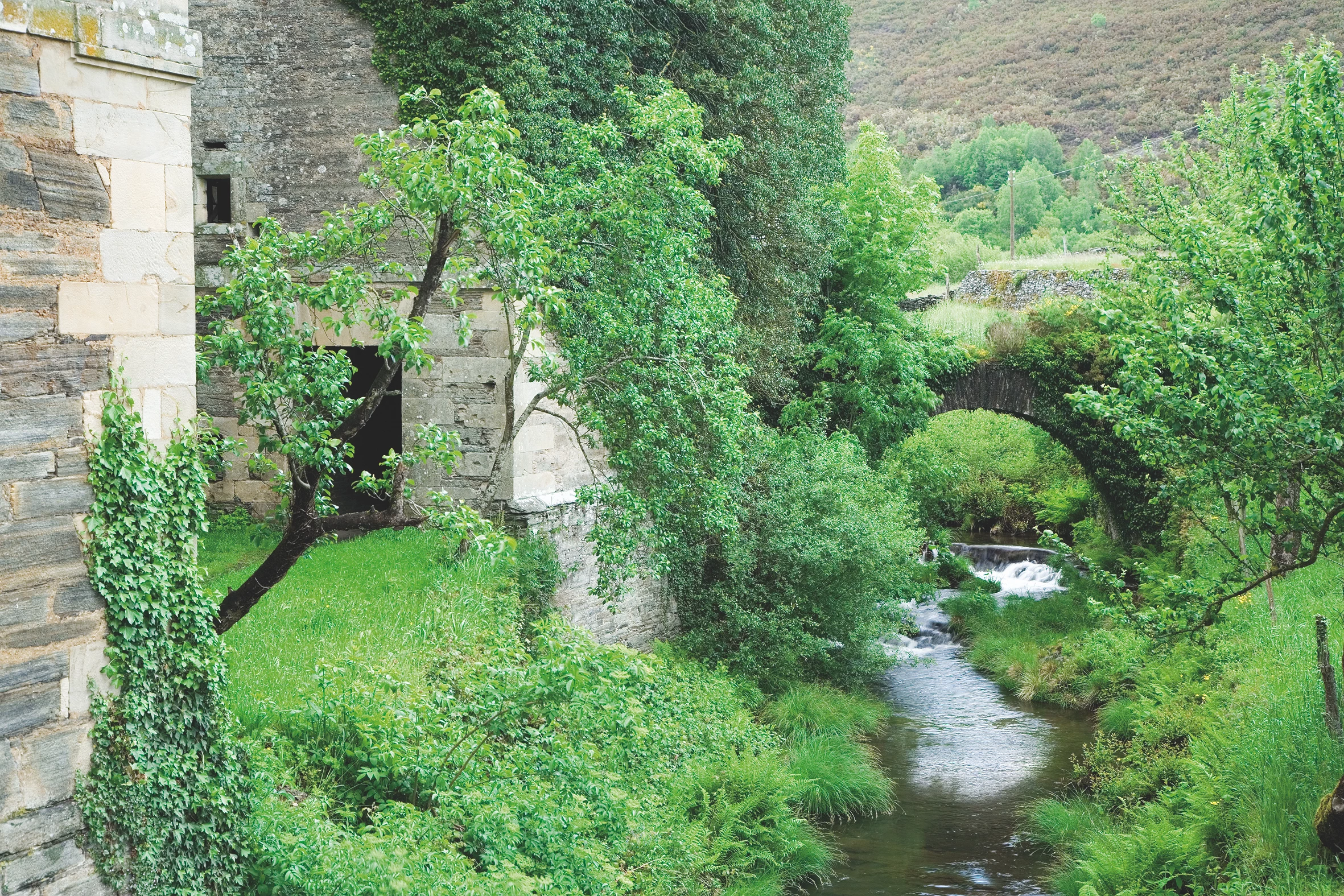
The route starts in San Cristobal, a place where we find numerous samples of popular architecture in its purest state, giving us the sensation of having gone back several centuries in time. From its chapel we see the valley of Rio Ahio covered with a beautiful blanket of native forest that dazzles us with its typical colors.
-
A Pena do Encanto Route
- San Tirso de Abres
- 4 km
- 1 hour and 20 minutes
- Download
From the municipal capital we go to the exit of the town towards Galicia, finding ourselves on the right hand side with the San Isidro square in whose center is the chapel with the same name, coinciding with the starting point of the route.
-
Water Route
- Taramundi
- 14 km
- 4 hours and 30 minutes
- Download
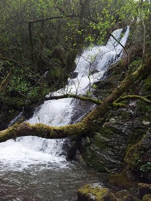
Its fourteen kilometers allow us to enjoy the water and its use for centuries in the rural environment. From the lower part of Taramundi we take a road that leads us to Mazonovo, where we can visit the Museum of Mills.
-
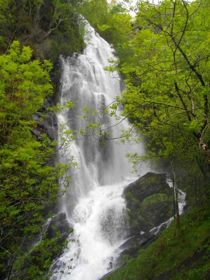
A Seimeira Route
- Santa Eulalia de Oscos
- 8 km round trip
- 3 hours
- Download
The route begins in the recreational area of Pumares; we cross the road and head parallel to the river to Pumares, a village of old ferreira activity, where we can still see the remains of an old mallet. From here, along a marked path, and leaving the river Agüeira to our left, we continue a slight ascent into a legendary forest characterized by riparian species (alders, ashes, willows, and hazelnut trees) and by oaks and chestnut trees that with their whimsical shapes are true monuments.
-
A Coba Route
- Santa Eulalia de Oscos
- 14.5 km
- 5 hours
- Medium - high
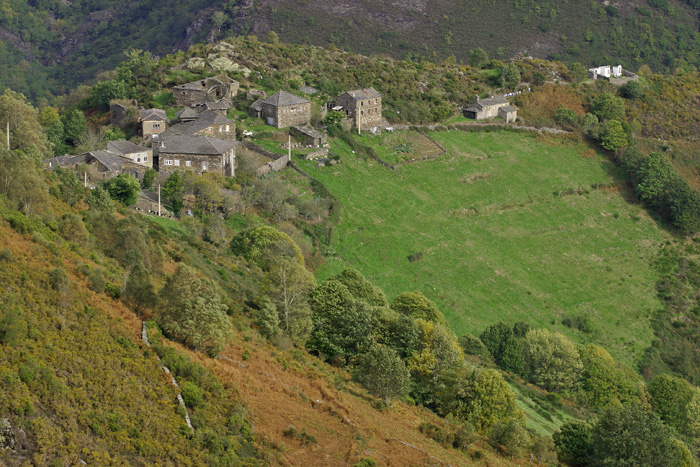
We start the route in the beautiful village of Ferreira, one of the best preserved of the municipality, where we can admire the popular architecture of the area while walking along its narrow paths in the shade of centuries-old vines.