
As Minas Route
- Castropol
- Circular route
- 5 km
- 1 hour and a half
- low
The route starts in the town of Tol. At the crossroads of the church of San Salvador, follow the signs to the parking area Fontequias, in the vicinity of the neighborhood of Cabaleiros.
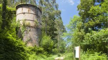
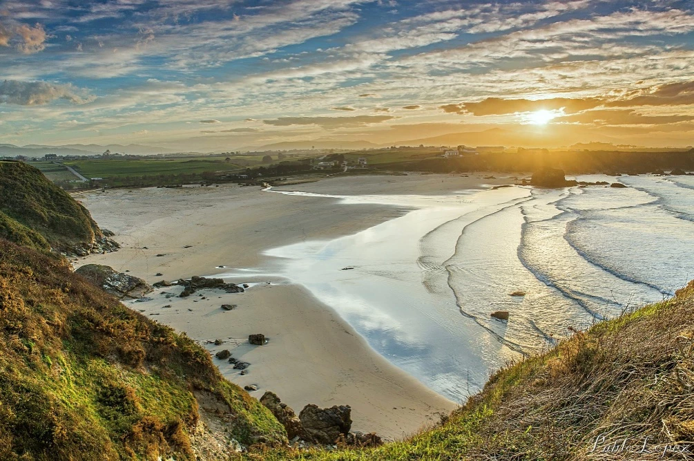
After leaving the vehicle, we head up the mountain on a paved road. On the way, we will see one of the most important cattle ranches in Asturias in terms of head of cattle, production and prizes. If you are interested in approaching it, the owners will be pleased to help you. Leaving the place of Boudois behind, we find a dirt road on the right that leads to the mine. At this point, the asphalt gives way to a nice path that runs through lush vegetation along the left bank of the Boudois stream. Turning right at the next crossroads we can see the remains of the furnace of the old iron mine. At this point an explanatory panel tells us some curiosities about it. We continue ascending to finally reach the top of Mount Arbedosa from where we can see a panoramic view that will undoubtedly surprise the traveler for its spectacular and chromatic variety. The blue of the coast blends with the green of the coast that appears tinted with black and white specks that make up small villages. It is worth stopping for a moment in Arbedosa and play to discover in the distance corners like Penarronda beach. From this point the route continues along an unpaved dirt track that descends to take us to the starting point.
Hiking trails
-
Route of the Mazo de Meredo
- Vegadeo
 13 km
13 km 4 hours
 half
half
The route starts in Piantón, a charming village that was once the capital of the council, located about two kilometers from Vegadeo in which we recommend a walk around the square and a visit to the church. We cross the so-called Roman Bridge and take the path to the left towards Arcilo. The path begins with a slight ascent through a deep eucalyptus forest mixed with remnants of native vegetation: chestnut, holly, laurel, … fed by numerous streams.
-
Vegadeo – Vegadeo Route
- Vegadeo
- 26,089 Km.
- Download
Download the route in PDF and KML and follow the route with your mountain bike or MTB. With different levels of difficulty, duration, slope and length. If you don’t have a bike you can rent one.
-
Route of Silence
- Villanueva de Oscos
- 12 km
- 5 hours
- High
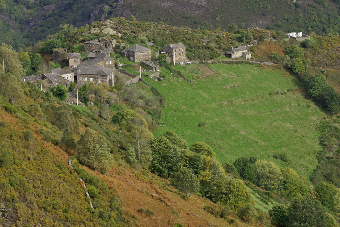
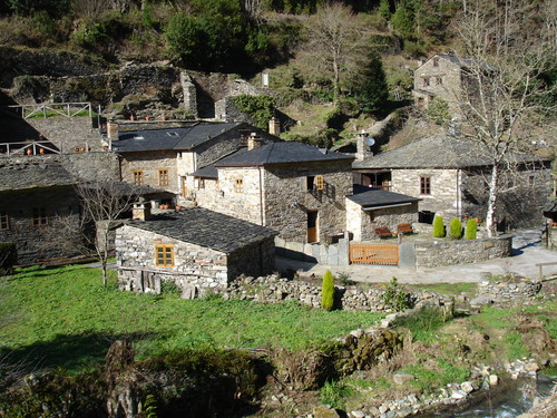
The route starts in San Cristobal, a place where we find numerous samples of popular architecture in its purest state, giving us the sensation of having gone back several centuries in time. From its chapel we see the valley of Rio Ahio covered with a beautiful blanket of native forest that dazzles us with its typical colors.
-
Coastal Path Tapia – Figueras
- Castropol
- 14 km
- 4 hours
- Download
In our region the route starts at Penarronda beach, declared a natural monument for its high environmental values, a beach that holds the blue flag and where you can not miss a good swim.
-
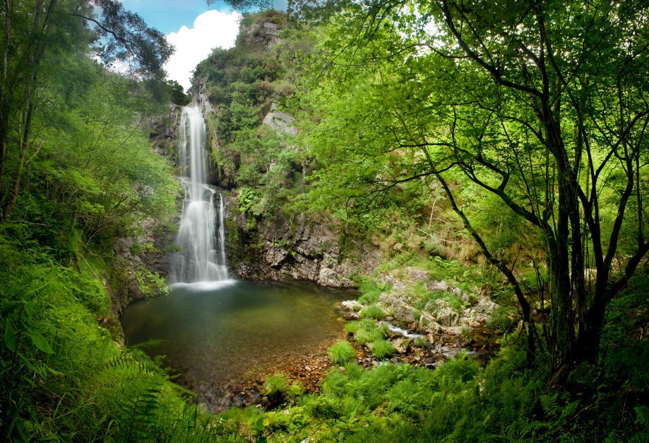
Cascada del Cioyo
- Castropol
- 3 km
- 1 - 2 horas
- Media
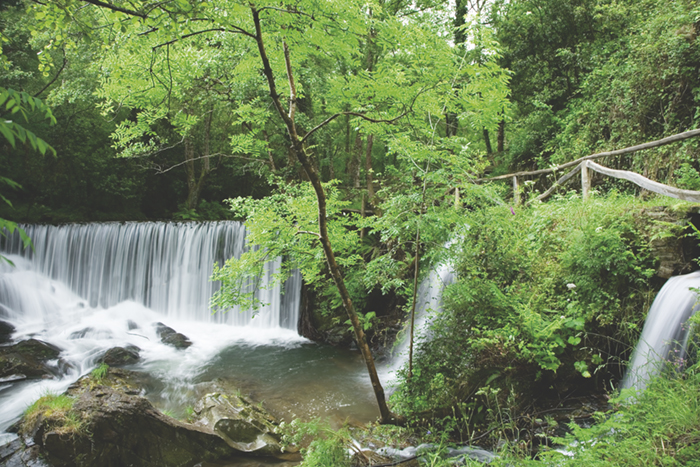
Escondida entre montañas y bosques del occidente asturiano, la Cascada del Cioyo es uno de esos lugares que parecen sacados de un cuento. El sonido del agua al caer, la vegetación exuberante que la rodea y la paz del entorno hacen de este rincón un destino ideal para quienes buscan conectar con la naturaleza. Una caminata entre árboles, pequeñas cascadas y paisajes que invitan a parar y respirar. Al final del recorrido, la gran cascada del Cioyo se abre paso con fuerza entre la roca, regalando una imagen de belleza salvaje difícil de olvidar.
-
Water Route
- Taramundi
- 14 km
- 4 hours and 30 minutes
- Download
Its fourteen kilometers allow us to enjoy the water and its use for centuries in the rural environment. From the lower part of Taramundi we take a road that leads us to Mazonovo, where we can visit the Museum of Mills.