
- Home
- What to visit?
- Interactive Museum of the Mills in Mazonovo
Interactive Museum of the Mills in Mazonovo
- Taramundi
- Museum
This museum was created to show the great variety of hydraulic and hand-operated mills that were used throughout history and in different parts of the world to grind cereals.
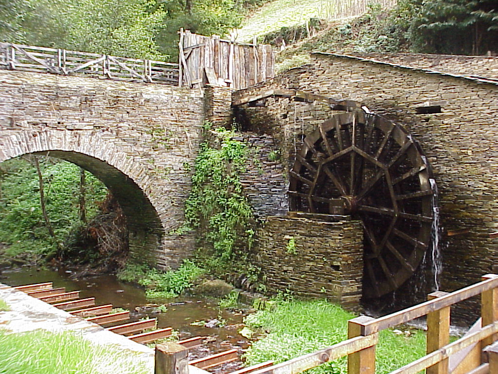
Through the different existing replicas you can grind as our ancestors did, see how the electric current is made, since the museum has its own power plant that gives energy to the whole set. With an outside visit along the supply channel you can see mills from other cultures such as Chinese and Brazilian. Arriving at the end of the walk to an artificial waterfall that serves as a reservoir to supply water to the set.
Building 1 . interactive
It includes hand mills (where you can grind as it was done in the past), and the following hydraulic mills: gravity mill (working continuously); medieval mill and Greek mill (the visitor can put them into operation by opening the water flow to the impeller).
Building 2
See how wheat was milled in Taramundi until a few decades ago in a hydraulic mill that is in continuous operation; next to it there is another exactly the same dismantled to be able to observe in detail all its elements and to better understand its operation.
In addition to the mill, there is a space reserved for understanding the process of transforming hydraulic energy into electrical energy with the power plant that still supplies energy to the complex today. An open-chamber Francis turbine, supplied with water by an aqueduct, has been in operation since 1941.
Exterior
Through the canal that supplies the complex, you can observe mills from other cultures, such as the Chinese mill, completely made of wood and moved by human power, and the Brazilian mill, which works hydraulically. Arriving at an artificial waterfall where the river is cut to supply water to the whole complex.
Mills
There are 19 mills in the museum: 8 manual, 6 hydraulic, 3 specific for children and 2 special mills (the latter two are life-size, but exhibited in ideal conditions, for the understanding of the different elements of these devices). The visit to the museum is completed with an outdoor walk, showcases of elements related to the mills and information panels.
Basic information
- 985 646 817
- 619 635 330
- informacion@mazonovo.es
- See website
- Mazonovo, s/n - Taramundi
Schedule
Every day
from 10:30 a.m. to 6:30 p.m.
Prices
Adults and children over 10 years old:
4,90 €
Children up to 10 years old (included):
2,90 €
Groups:
3,40 €/person
What to see?
-
Piantón
- Vegadeo
- Heritage
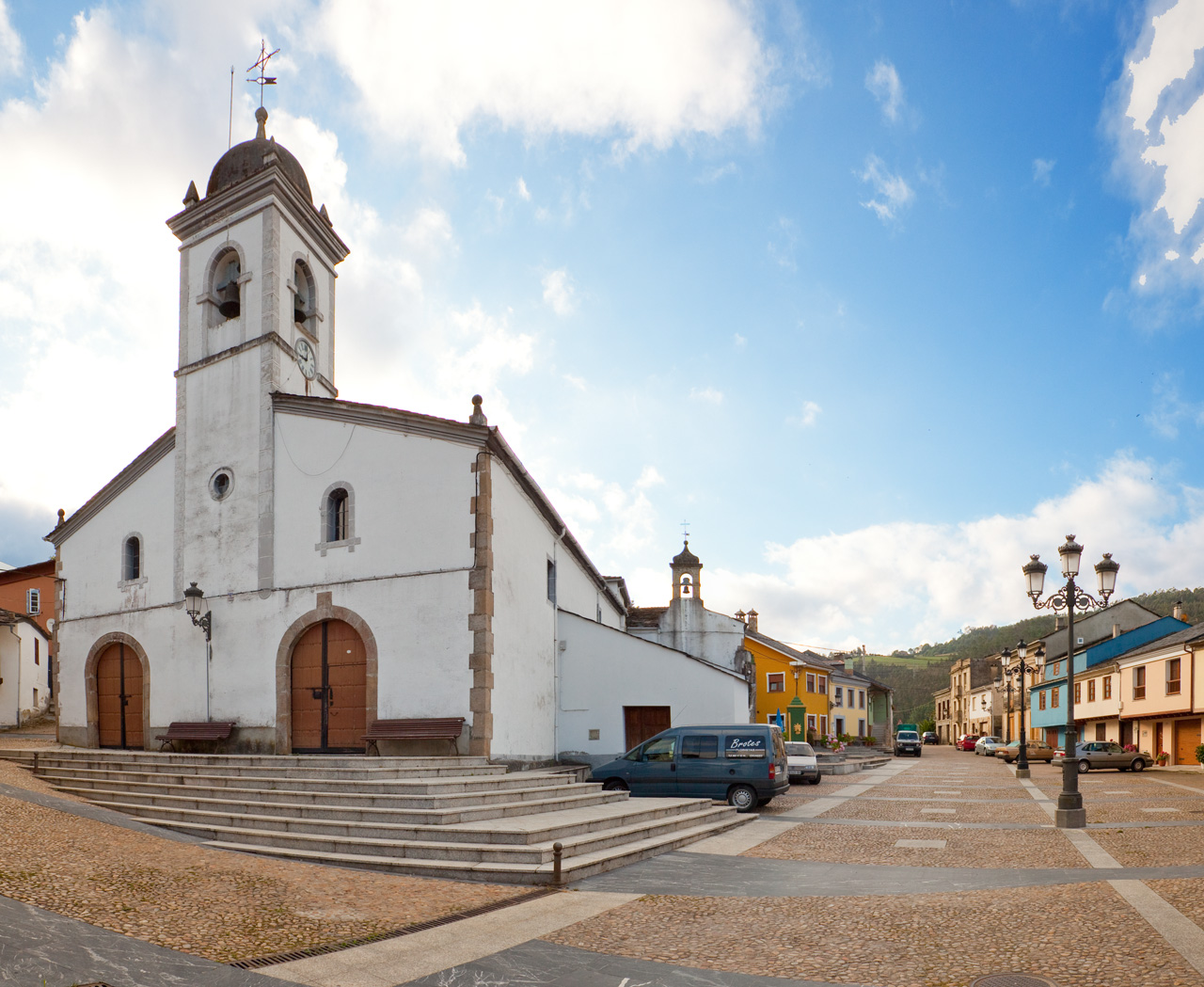
Two kilometers from the town of Vegadeo is the village of Piantón, which can be reached on foot as the entire route has a sidewalk. It is a beautiful walk along the Suarón River.
-
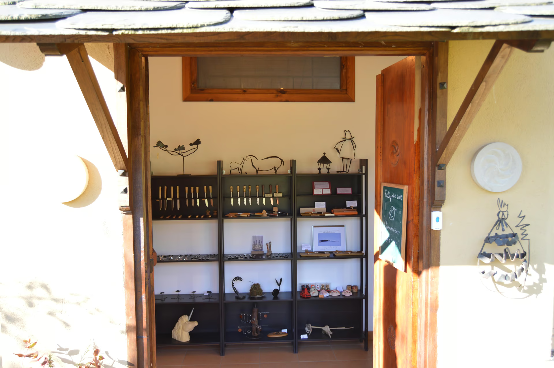
Hiottoko artistic forge and cutlery workshop-shop
- Santa Eulalia de Oscos
- Craft
Traditionally, in Santa Eulalia de Oscos, knives have been made for more than a century. Nowadays Jorge (knifemaker) and Keiko (metal craftswoman) maintain this tradition developing this ancient craft to which they add part of the Japanese ancestral wisdom.
-
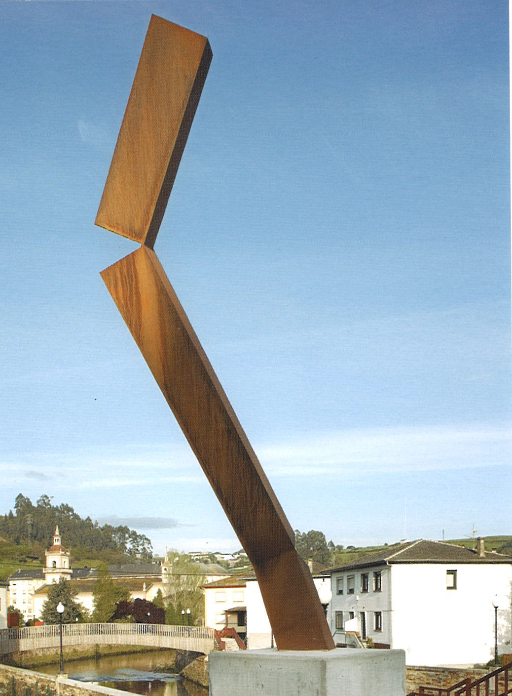
Contemporary art sculptures and sculptures by César Montaña (Vegadeo)
- Vegadeo
- Sculpture
The town of Vegadeo has the peculiarity of being crossed by two rivers: the Monjardín and the Suarón, which have twelve bridges that cross them (six each). Taking advantage of this circumstance, the idea was that visitors to Vegadeo could get to know the town center by crossing these bridges, and enriching the visit with a sculpture on each of them.
-
Los Castros
- San Martín de Oscos
- Heritage
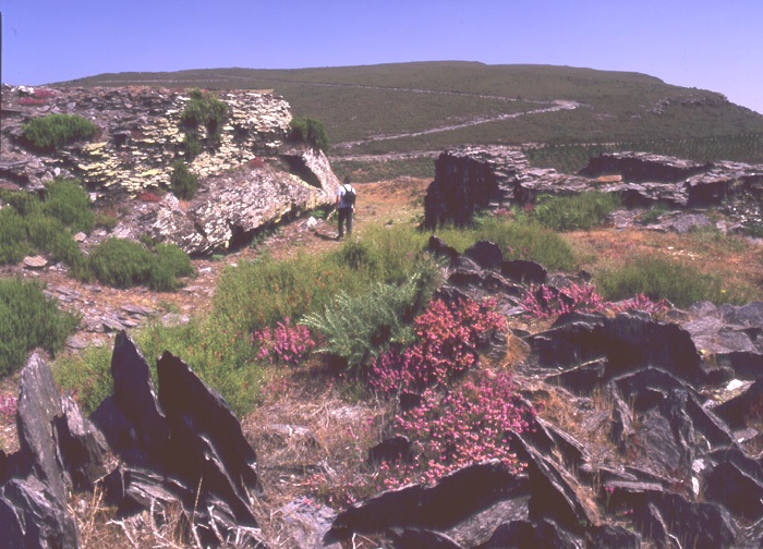
The castros are population centers of an eminently strategic and defensive nature. They are found throughout the northwest of the peninsula (castreña culture). These settlements arise in the transition from the Bronze Age to the Iron Age, reaching its peak during the Second Iron Age.
-
Las Minas
- San Martín de Oscos
- Mines
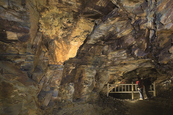
There are remains in the Oscos region that tell us that mining was an activity that was developed in the area since prehistoric times. Before the conquest of the Romans, the inhabitants of this region were already looking for gold nuggets in the river placers. But it was after the arrival of the Romans that this industry was boosted. In the Flavian period, at the beginning of the first century A.D., a first golden age was experienced. The castros (fortified settlements) resurged as a result of the exploitations and the landscape was dotted with small industries of which there are still remains such as: forges, function furnaces and samples of the technology that was used for the exploitation of the deposit.
-
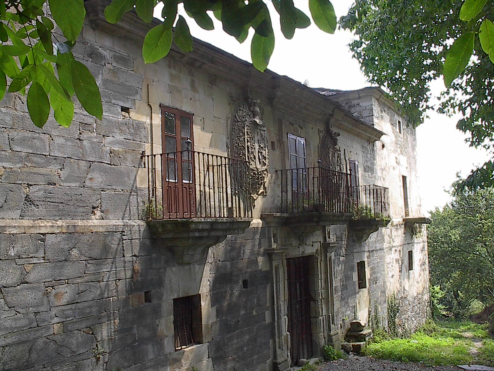
Mon Palace
- San Martín de Oscos
- Heritage
Among the artistic heritage of San Martín de Oscos it is worth mentioning the legendary and majestic Palacio de Mon. Conditioned by the sloping terrain, its main facade faces south while its foundations adapt to the slope, fitting into the west bay below ground level while developing height to the east.